DENVER (KDVR) — Monsoonal storms dumped torrential rainfall on parts of the Front Range on Monday and Tuesday. Some spots across the metro saw over 3 inches of rain in just 48 hours.
Denver has had a strong showing of the monsoon so far this year with multiple heavy rain events over the last two months. Monday and Tuesday’s storms dumped the highest totals of the season for many areas.
Storms first developed Monday afternoon during the evening commute when flash flood warnings and severe thunderstorm warnings were issued across the south and east sides of metro Denver.
There were several reports of flooded roadways, hail, and strong winds. Some places picked up over 2 inches of rain in less than 30 minutes Monday afternoon.

Another round of steady moderate to heavy rainfall moved in Tuesday morning into the midday hours. This brought more impressive rainfall totals to some of the same areas that had just seen heavy rain the night before.
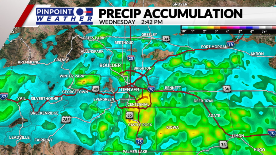
Above is a map of the radar estimated rainfall accumulation from Monday and Tuesday combined. The areas in orange represent totals higher than 3 inches, with yellow representing totals over 2.5 inches.
On the Front Range, the southeastern corner of metro Denver and parts of the Palmer Divide saw some of the highest totals.
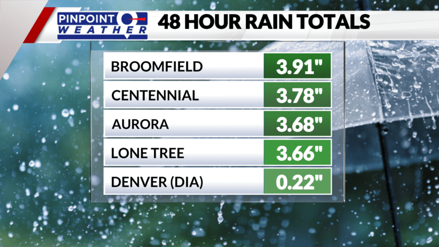
Broomfield picked up 3.7 inches of rainfall on Tuesday morning in just two hours, bringing the two-day total to 3.91 inches.

Places like Centennial, Aurora and Lone Tree also saw over 3.5 inches of rainfall in just 48 hours. For most of these locations, that is about 20% of their average annual precipitation.
Denver International Airport, the official measuring site for the city of Denver, was missed by most of the heavy rain and only recorded .22 inches of rain on Monday and Tuesday.


