DENVER (KDVR) — As we head into the summer, more severe storms are expected and that brings hail to Colorado.
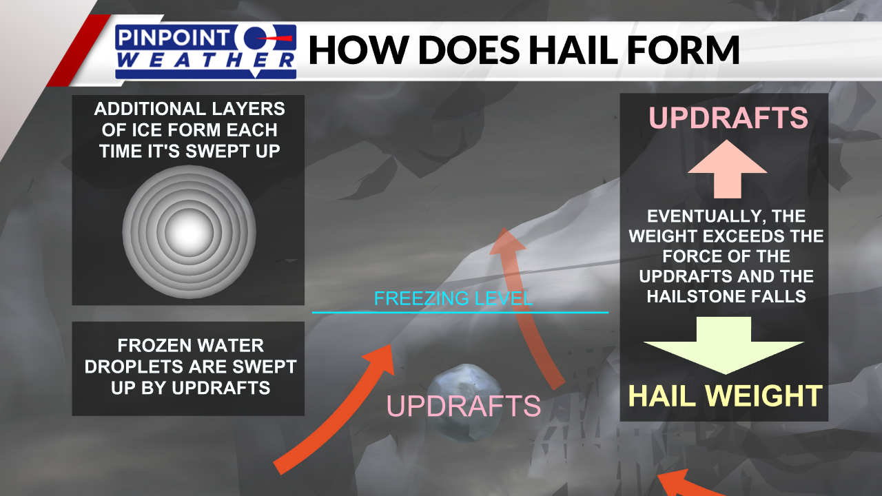
Hail forms in strong thunderstorms as strong updraft winds lift frozen water droplets into the cloud. As the water droplet goes into a freezing layer it becomes a small hail stone.
That hail stone then collides with water droplets which stick to the ice ball. Those water droplets then freeze and the hail stone grows in size.

Updrafts continue to hold the hail stone aloft until it becomes so heavy that it falls out of the cloud. The longer the hail stone is held aloft, the larger it will become.
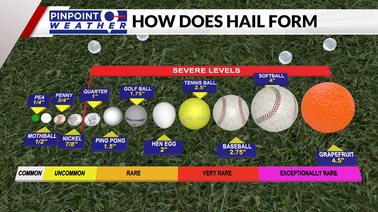
Hail stones vary in size from pea-sized (0.25 of an inch) to tennis ball size (2.5 inches), and even the size of a grapefruit (4.5 inches). A hail stone the size of a quarter (1 inch) is the start of the severe level of hail and when the National Weather Service will issue Severe Thunderstorm Warnings.

Small hail, less than half an inch is common with thunderstorms. Up to an inch is uncommon, but can be seen with stronger storms. Hail reaching a size larger than that of a ping pong ball is rare, while bigger than a tennis ball is even more so. Hail the size of a softball or larger isn’t seen much as it is exceptionally rare.

