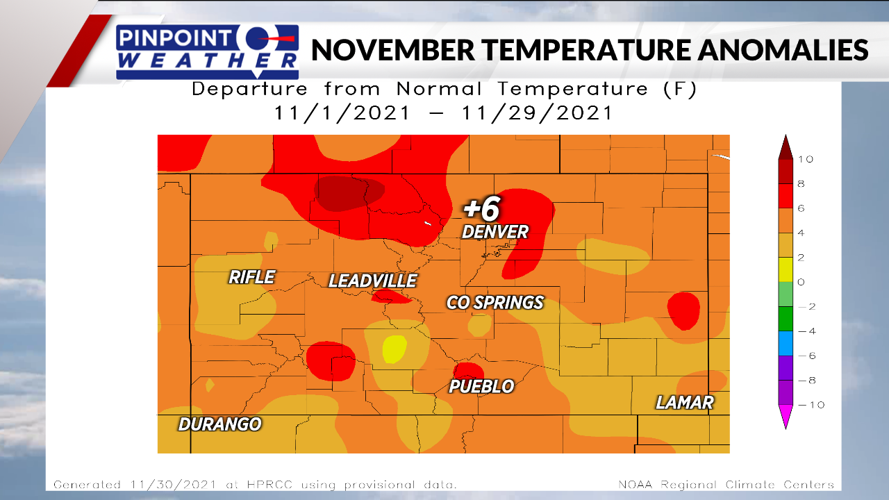
DENVER (KDVR) — Tuesday marks 223 days since snow was last measured in Denver. Not only has it been a dry month, it has also been a warm month.
Meteorologist Chris Tomer said that there has been a 6-degree plus departure from the normal temperature in Denver for November.

After a look at weather history from the National Weather Service, this dry November could be a bad sign for snow lovers.
Here’s what we found during our research:
Warmest Novembers on record
| Rank | Average Temperature | Year |
| 1 | 50.9 degrees | 1949 |
| 2 | 47.2 degrees | 1999 |
| 3 | 46.2 degrees | 1933 |
| 46.2 degrees | 1914 | |
| 5 | 45.9 degrees | 1981 |
| 45.9 degrees | 1927 |
Snow totals following warmest Novembers on record
| Year | Total |
| 1949-1950 | 51.2 inches |
| 1999-2000 | 45.6 inches |
| 1933-1934 | 45 inches |
| 1914-1915 | 44 inches |
| 1981-1982 | 26.7 inches |
| 1927-1928 | 57 inches |
The average snowfall for the top six warmest Novembers on record is 44.9 inches. The average snowfall each winter in Denver is 56.5 inches.
Snow totals over the last 10 years
Here’s a look at the snowfall season totals for the last 10 years, according to the National Weather Service:
- 2020-2021: 80.2 inches
- 2019-2020: 57.6 inches
- 2018-2019: 48.1 inches
- 2017-2018: 25.7 inches
- 2016-2017: 21.8 inches
- 2015-2016: 72.8 inches
- 2014-2015: 57.8 inches
- 2013-2014: 38.4 inches
- 2012-2013: 78.4 inches
- 2011-2012: 55.6 inches
- 2010-2011: 22.8 inches
Seasonal records
- The lowest seasonal snowfall was 21.3 inches measured in 1888-1889
- The highest seasonal snowfall was 118.7 inches in 1908-1909

