DENVER (KDVR) — We are forecasting 1-4 inches of snow accumulation across the Eastern Plains early today. This includes Limon, Agate, and the I-70 Corridor. It will turn drier midday into afternoon before the next wave of snow arrives tonight.
Only a few flurries in Denver on Monday, cloudy skies, and highs in the 30s. Light snow arrives by 9pm.
- Rush Hour Timeline:
- Monday morning: Snow Eastern Plains
- Monday night: Light snow moves into Front Range by 9 p.m.
- Tuesday morning: Light snow Denver and Front Range.
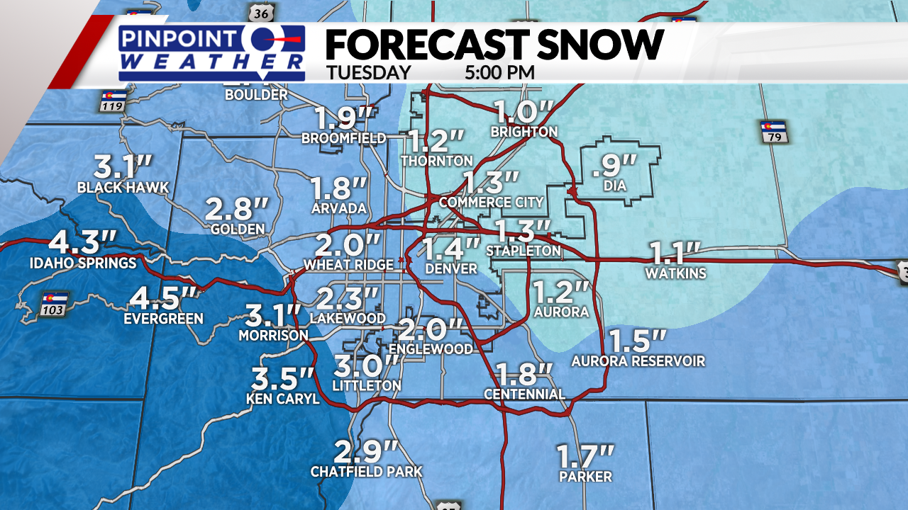
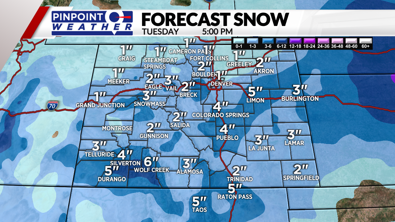
The next storm system arrives tonight and runs through Tuesday. Tuesday is a Pinpoint Weather Alert Day. Roadways could be snow covered on Tuesday morning. 1-3 inches of snow accumulation in Denver, Boulder, Loveland and Fort Collins. 1-4 inches across the Palmer Divide and Foothills. Highs in the 20s and 30s.
The mountains can expect 1-4 inches of new snow this afternoon through Tuesday. Good skiing on Tuesday. Colder temps in the teens and low 20s.
Denver turns drier Wednesday-Sunday. Warm at 60 on Friday.
The mountains stay active with additional snow hitting on Saturday and Sunday.
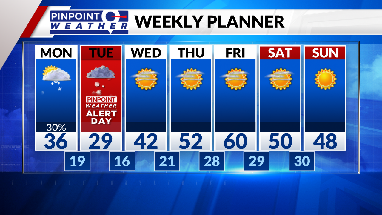
Turning drier Wednesday-Sunday in Denver. Much warmer at 60 on Friday.
But, the mountains stay active with additional snow coming

