This is an archived article and the information in the article may be outdated. Please look at the time stamp on the story to see when it was last updated.
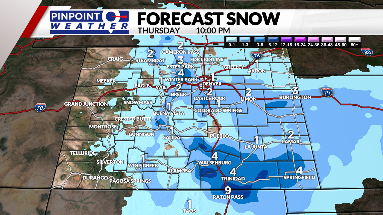
DENVER (KDVR) — The Front Range had a messy, sloppy, and wet commute for St. Patrick’s Day.
Thursday is a Pinpoint Weather Alert Day.
Most of the metro roads were wet. The heaviest snow landed west and south of the Denver area. The snow has tapered off.
Overall, this will be valuable moisture for the Front Range. Skies will clear into Friday, bringing sun and temps in the 40s and 50s.

Saturday is looking forward to sunny skies and temps near 60. Clouds will come back on Sunday, but temps will sit in the 60s.
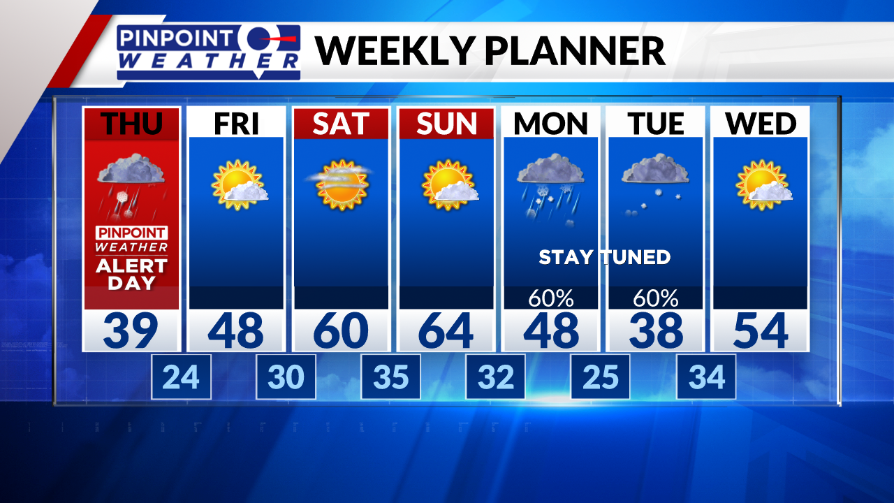
The next storm system hits Monday and Tuesday with a rain/snow mix in Denver, changing to all heavy, wet snow Monday night into Tuesday morning. Snow accumulation is possible.

