DENVER (KDVR) — Snow missed Denver but did hit the Palmer Divide including Monument, Parker, and Castle Rock with light accumulations. Heavy snow at the ski areas along I-70 and North. Most places received 6-14 inches including Aspen/Snowmass, Vail, Breck, and A-Basin.
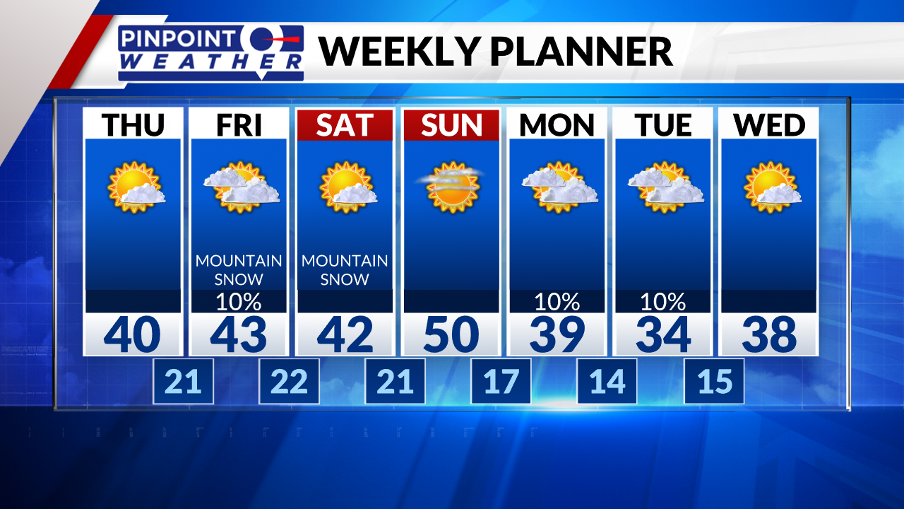
We will have sunshine today in Denver and across the Front Range as this storm exits. Colder highs around 40.
Avalanche Warnings blanket the Mountains through Friday.
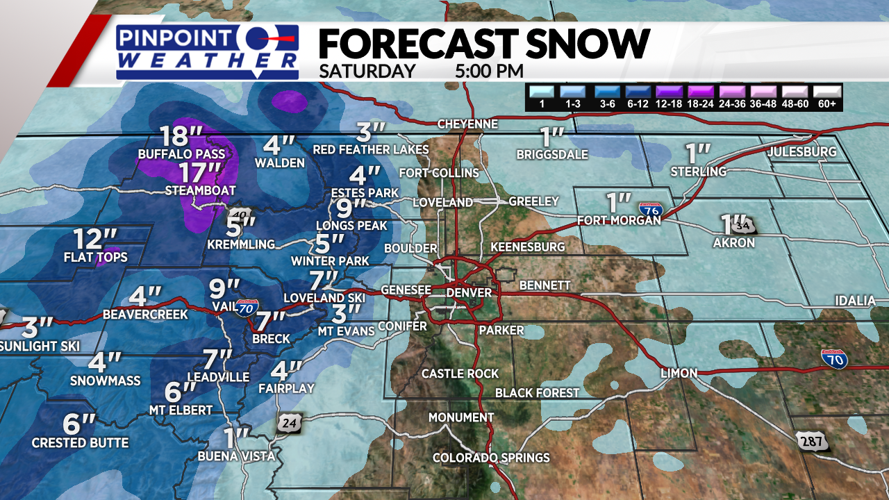
The next storm system (Northwest Flow) arrives tonight through Friday and lingers into Saturday for the Central and Northern Mountains. 6-18″ of new snow at Steamboat, Aspen/Snowmass, Vail, Breck, A-Basin, Winter Park, Copper, and Loveland. Colder highs in the teens.
That storm system could drop a few flurries on Denver Friday. The Northeastern Plains could see up to 1″.
Satuday looks dry in Denver and across the Front Range. Lingering snow in the Mountains.
Sunday looks totally dry except for the extreme Northern Mountains.
A slight chance for snow on Monday.


