DENVER (KDVR) — Wednesday is a Pinpoint Weather Alert Day. Conditions will start dry across most of the Front Range. Snow will arrive in the mountains and northern Front Range foothills first.
The Pinpoint Weather Team said the bulk of the snow will fall in Denver between 4-10 p.m.
Here’s a look at the timing of when the snowfall will arrive:
- Denver: 2-4 p.m.
- Fort Collins: 7-10 a.m.
- Northern mountains: 6-10 a.m.
- Evergreen: 2-4 p.m.
- Estes Park: 7-10 a.m.
- Highlands Ranch: 2-4 p.m.
- Castle Rock: 3-4pm.
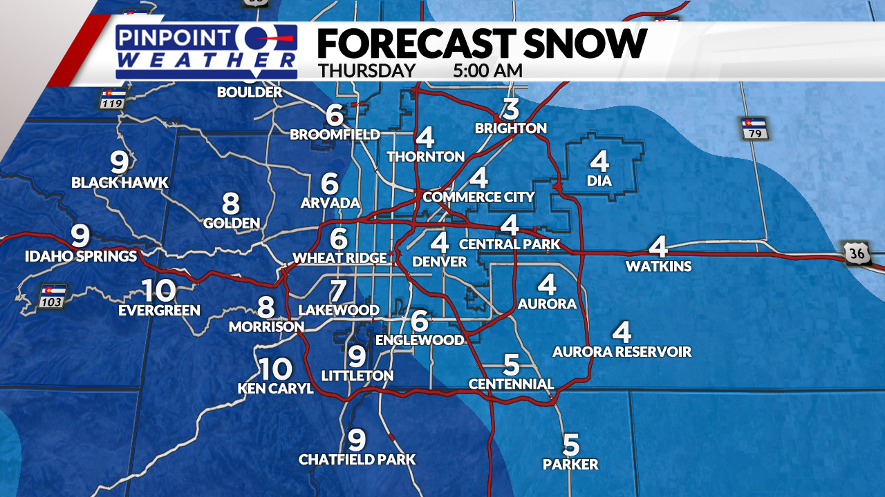
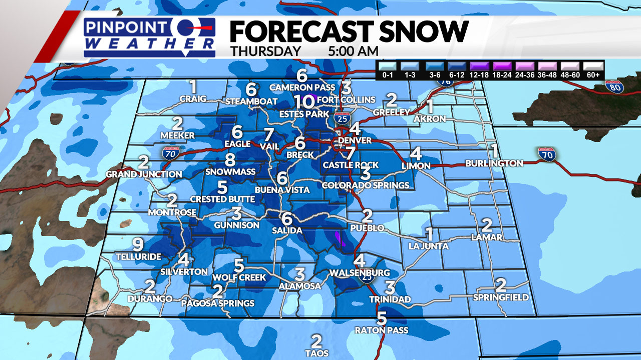
Here are the snowfall totals expected by 5 a.m. Thursday:
- Denver: 2-4 inches
- Fort Collins: 2-4 inches
- Castle Rock: 3-6 inches
- Foothills: 4-10 inches
- Mountains: 4-10 inches
- Eastern Plains: 1-3 inches
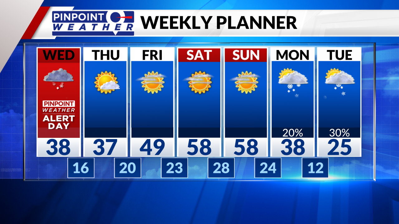
Snow will taper off around midnight and skies will clear into Thursday morning. Highs will be in the 30s on Thursday.


It will be sunny and dry with highs in the 50s Friday through Sunday.

The next storm system arrives Monday and Tuesday with snow.
- Closings & Delays: Full List
- Interactive Radar
- Delays and cancellations at Denver International Airport
The Pinpoint Weather Team will continue to update the forecast multiple times each day. Be sure to download the free Pinpoint Weather App to stay up-to-date with the newest data as it comes in.

