This is an archived article and the information in the article may be outdated. Please look at the time stamp on the story to see when it was last updated.
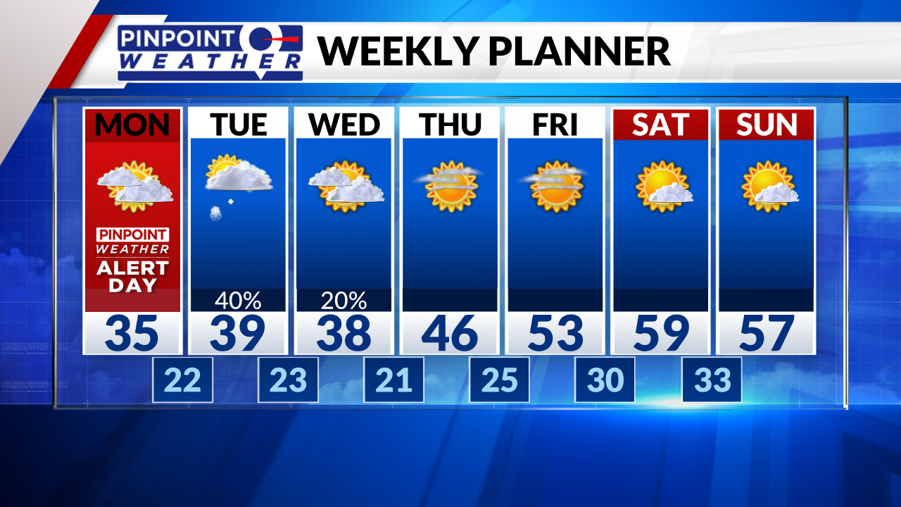
DENVER (KDVR) — We are forecasting morning clouds then breaks of sunshine in Denver, Boulder, Loveland, and Fort Collins. The big dig and melt starts today. Highs will be in the mid-30s.
The mountains can expect lingering morning snow showers then clearing by afternoon.
The official storm total is 27.1 inches at DIA making it the fourth biggest snowstorm in Denver recorded history.
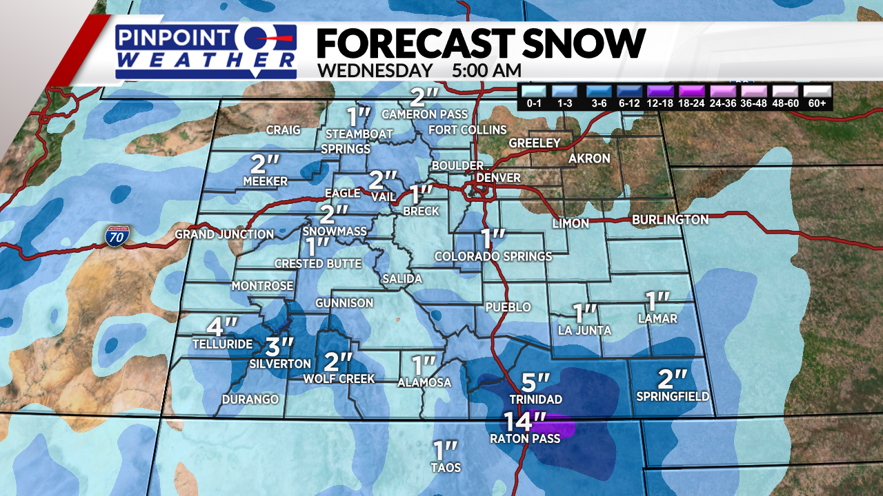
The next storm system arrives on Tuesday into Tuesday night and into Wednesday early morning. A dusting of snow is possible in Denver. One to two inches of accumulation possible in the Foothills and across the Palmer Divide.
Skies will clear Thursday-Saturday. Highs surge into the 40s and 50s.
Another storm system approaches on Sunday-Monday. Snow is possible.