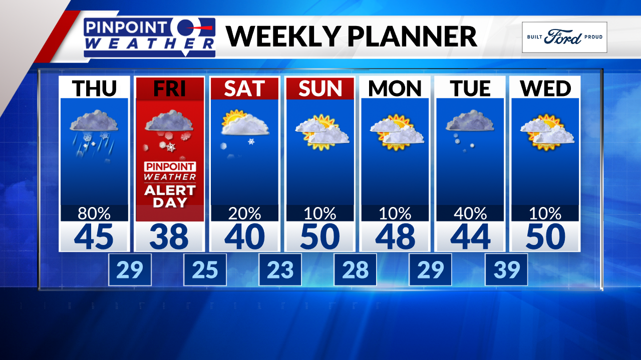
DENVER (KDVR) — We are forecasting a dry morning rush but the evening rush hour is a different story. Rain and or snow arrives between 3 and 5 p.m., then changes to all snow. Snow tapers-off during the morning rush hour on Friday.
We’ve issued a Pinpoint Weather Alert for Friday morning. Additionally, the National Weather Service has issued a winter weather advisory for the metro-Denver area, parts of the foothills and into the northeastern corner of the state.
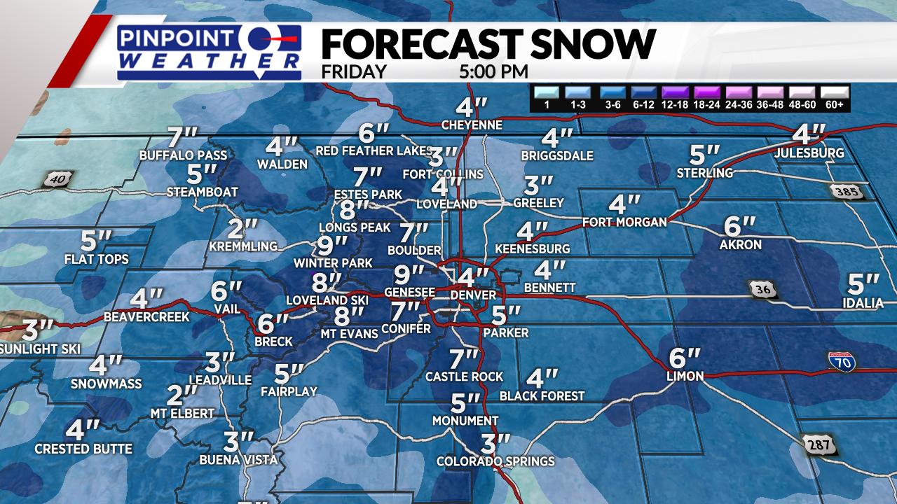
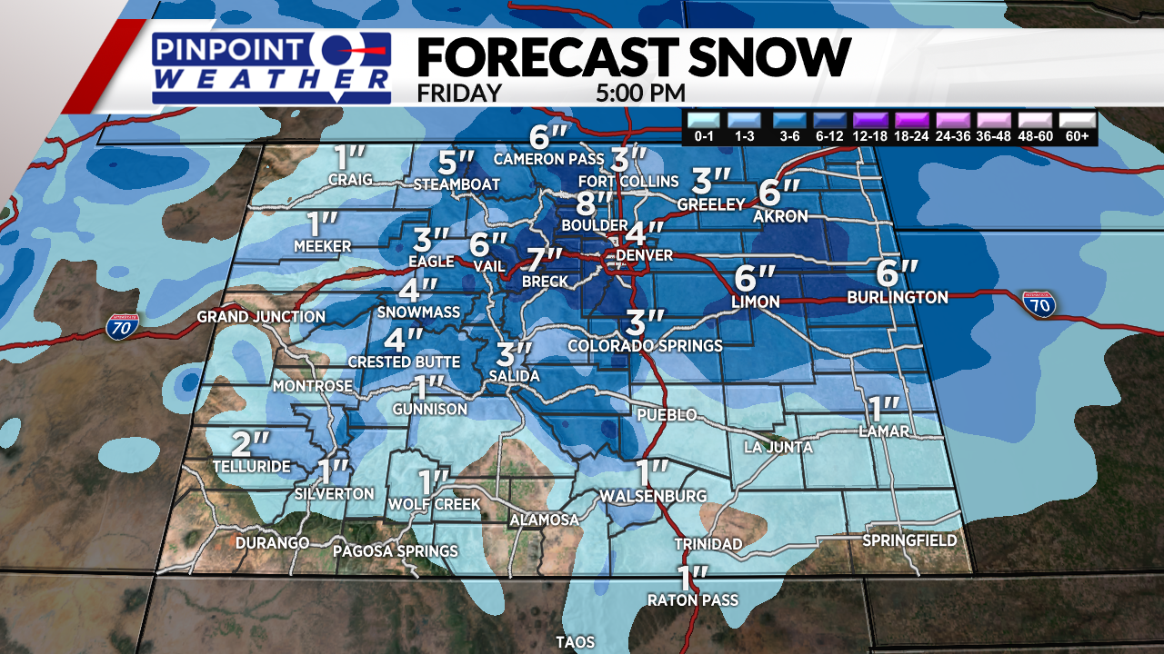
Snow hits the mountains earlier today and continues into Friday morning. We expect 3-8 inches of accumulation with a few pockets up to 12 inches on the Divide high peaks.
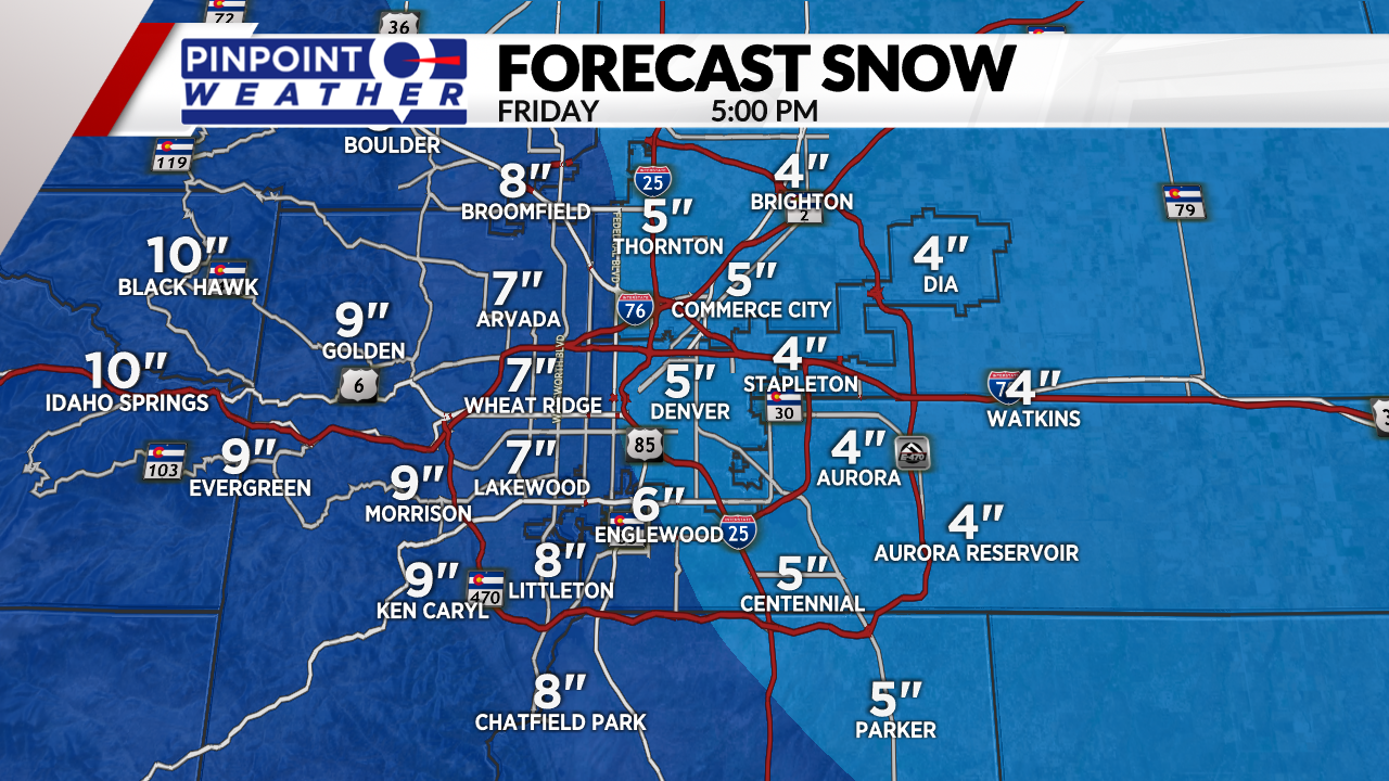
Total snow in Denver is 2-6 inches by Friday morning with some melting too. Expect wet, sloppy roads in Denver Friday morning and snowy roads West and possibly South.
Boulder could see 6-8 inches. Foothills 4-10 inches. Mountains and ski areas 3-10 inches with pockets of 12″. Palmer Divide 2-6 inches. Fort Collins and NOCO 2-6 inches.
Lingering snow showers (20%) early Saturday in the Mountains then turning drier.
Dry on Sunday.
The next cold front with snow hits Denver Monday night into Tuesday morning.
