DENVER (KDVR) — The Pinpoint Weather Team is forecasting a 60% chance for scattered rain showers across the Front Range on Wednesday. Highs in the 50s.
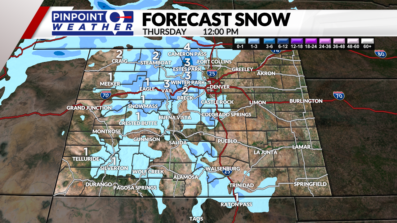
The mountains can expect 1-4 inches of additional snow above 8,000 ft. Temperatures will be in the 30s and 40s.
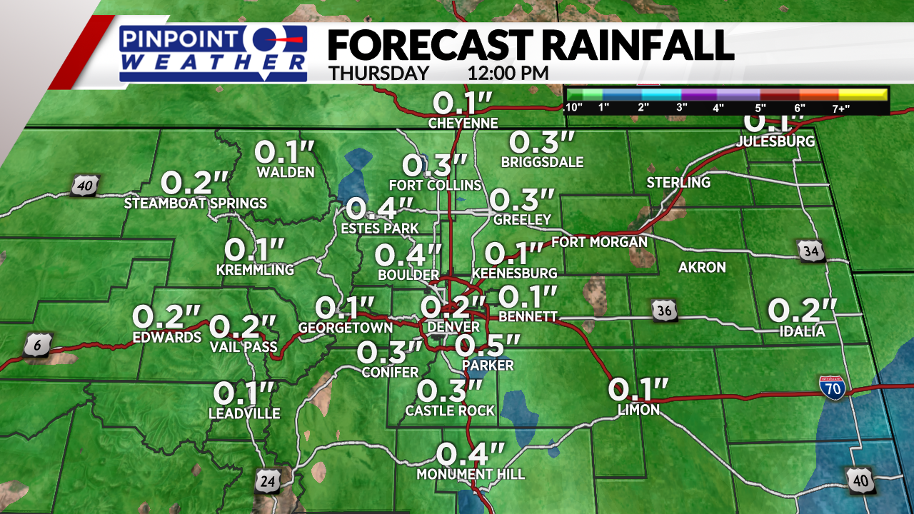
Lingering precipitation and fog will appear early Thursday, then turn drier. Front Range highs will be in the 60s.
Drier and much warmer conditions will come around Friday through Saturday with temps in the 80s and sunshine.
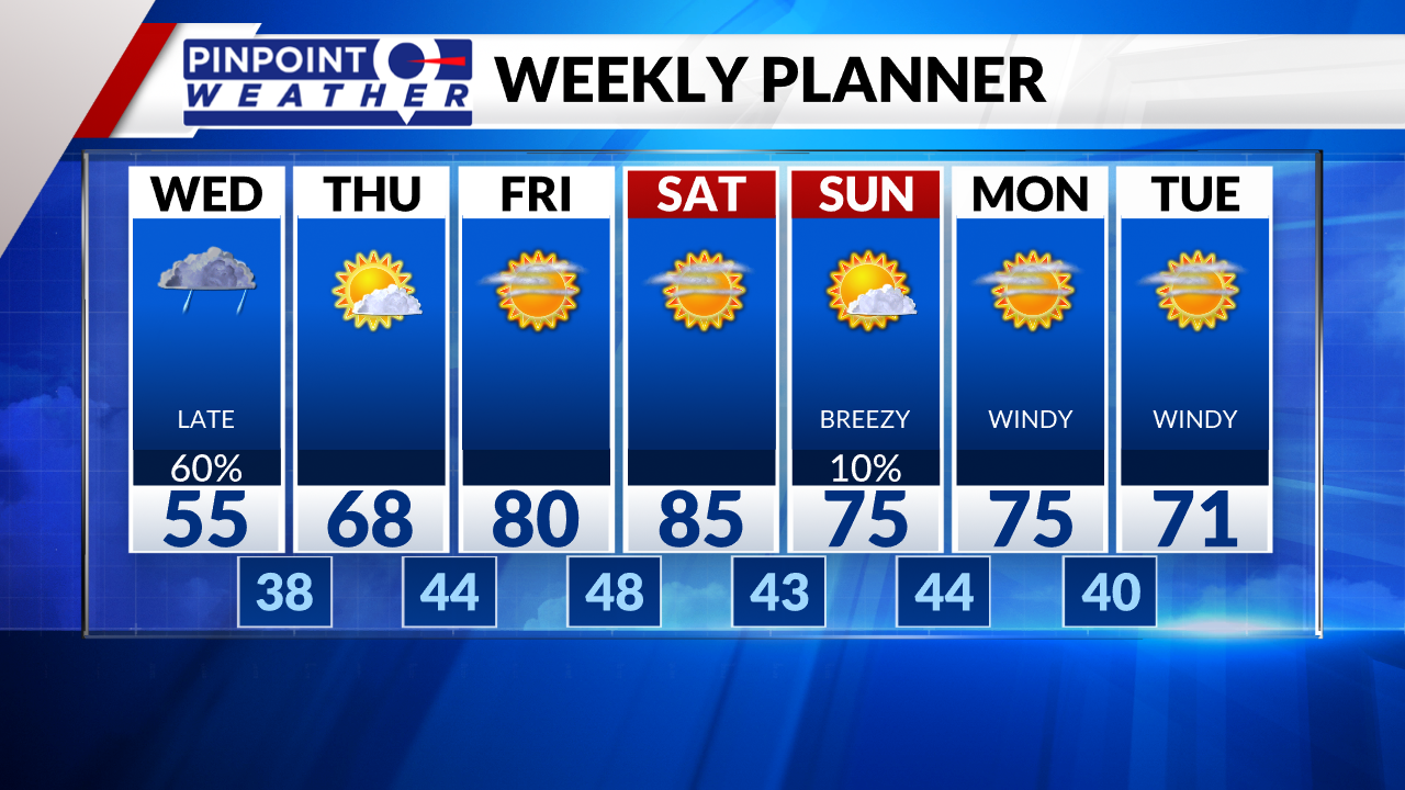
A cold front slides through late Saturday and into Sunday morning. Highs will drop 10 degrees with a 10-20% chance of a rain shower or thunderstorm. Otherwise, skies will be partly cloudy with breezy afternoon wind going 15-30 mph.
Strong wind will return most of next week in the afternoon, going around 15-45 mph.

