DENVER (KDVR) — We set two record lows in Denver. The first occurred Tuesday night at 31 degrees. This ties 1962 for the earliest first freeze on record. The second record low occurred Wednesday morning at 31 degrees.

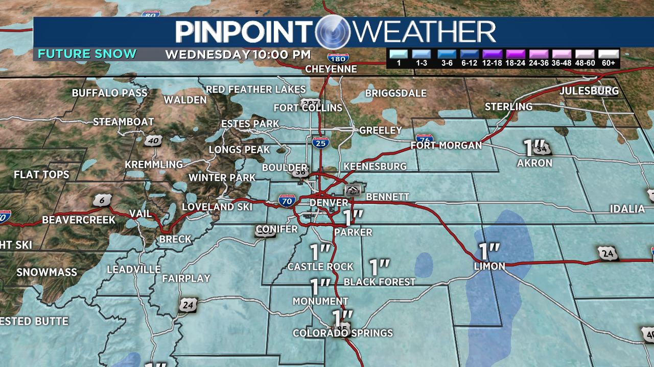
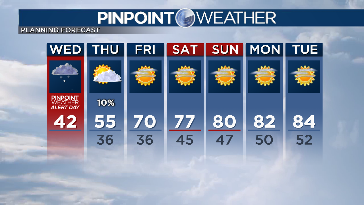
Also, expect light snow in Denver and across the Front Range Wednesday morning. Then turning drier Wednesday afternoon. Overnight lows hit 35 into Thursday morning.
We continue our Pinpoint Weather Alert Day for Wednesday morning for the record cold and light snow.
Live Updates: Everything you need to know about September snow in Colorado
The very last part of this storm system slides through on Thursday. It’s a cut-off low pressure. It spreads light rain/snow through the mountains and Plains. Another 1- 3 inches of mountain snow accumulation. 10% chance of a rain shower in Denver. Highs in the 40s and 50s.
Then a completely different weather pattern moves in for the weekend. Highs surge into the 70s and 80s with sunshine.


