DENVER (KDVR) — It has been a rainy two days on the Front Range with up to 3 inches measured in some spots from monsoonal storms on Monday and Tuesday.
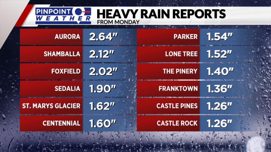
Some of the storm reports from Monday afternoon’s heavy rain are listed below. The biggest impacts were felt across the south and east sides of metro Denver and down along the Palmer Divide, where more than 2 inches of rain fell in less than 30 minutes in some spots.
There was street flooding during the evening commute thanks to the Monday storms.

More heavy rain fell on Tuesday morning, dumping up to 3.7 inches in Broomfield where there were flooded streets. About 25% of their annual average rainfall fell in 2 hours on Tuesday.
The rain will continue to push east Tuesday afternoon and onto the plains. Metro Denver and the Front Range will begin to dry out with only light rain possible for the rest of Tuesday night.
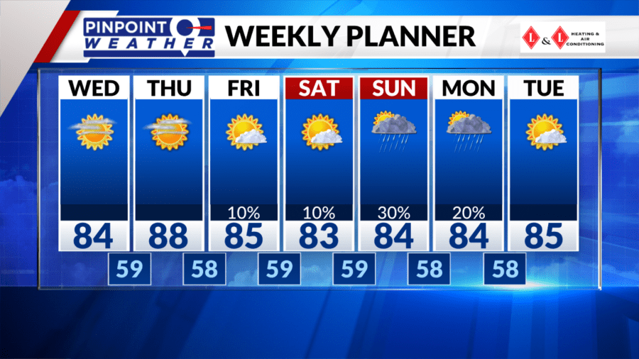
Dry weather and sunshine will move back in Wednesday and Thursday with temperatures heating up to the 80s.

Friday will stay warm with a 10% chance of an isolated storm. Storm chances will stay low on Saturday before increasing to 30% Sunday afternoon.

