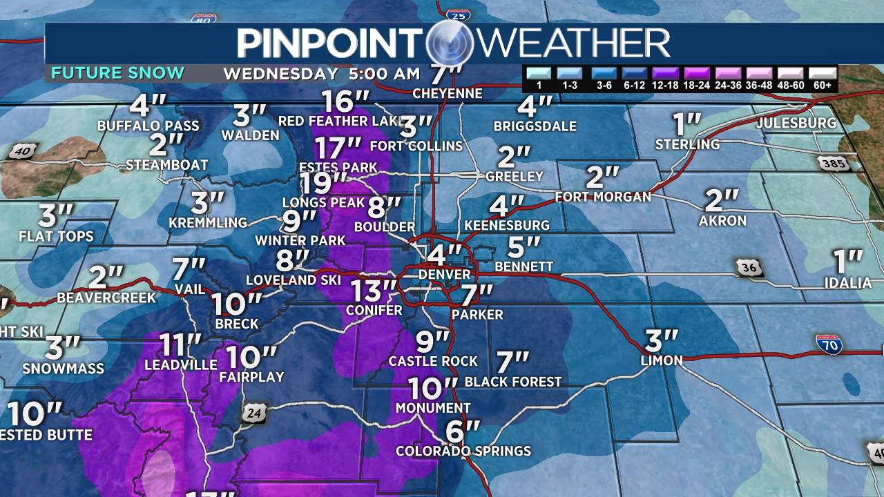
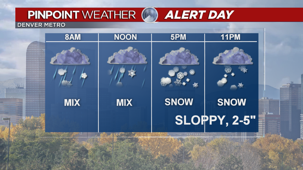
DENVER (KDVR) — The storm is on track. It should change to a rain/snow mix around 9 a.m.-Noon. Then to all snow by 5 p.m. tonight through 5 a.m. Wednesday. That’s our best chance for accumulation in across I-25.
Overnight season swap: Read live updates here on September Winter Storm
We will see a lot of melting today. Pavement is warm. Fifty percent of the snow could melt in Denver and Fort Collins. Wet, sloppy snow could accumulate on trees, roofs and grass. Highs will be in the 30s. A Winter Weather Advisory is in effect.
The best snow will occur above 6,500 feet. That is the Foothills, Palmer Divide, and mountains. Winter Storm Warnings are in effect for those areas.
Winter Storm Checklist for Colorado
The Foothills and mountains can expect 6-14 inches or more by noon Wednesday. Clearing after that. Trees may get bent.
The Palmer Divide can expect 3-8 inch totals by Noon Wednesday with some melting.
Our first freeze of the season occurs overnight into Wednesday morning. 28-32 degree lows.
Another freeze is possible Wednesday night into Thursday morning, 28-32 degrees.
It will be drier and warmer this weekend.


