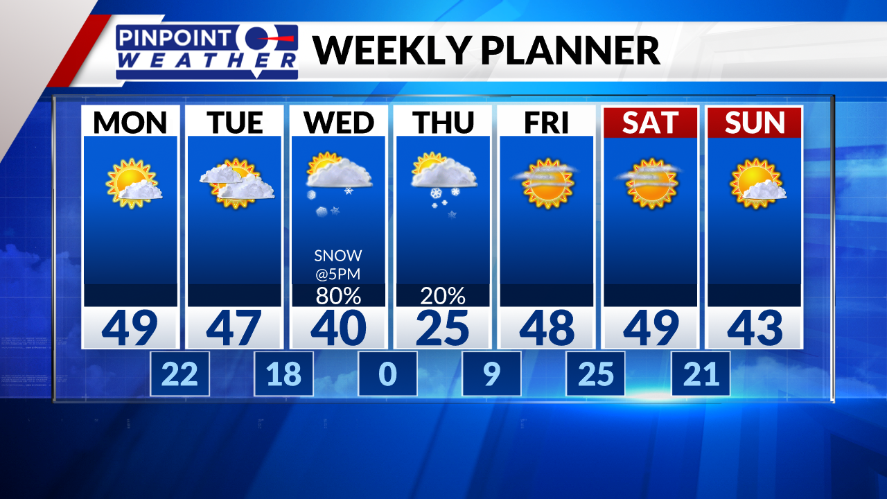
DENVER (KDVR) — We are forecasting a dry Monday with high cloudiness and Front Range highs in the mid 40s.
The mountains stay dry with sunny skies, high clouds, and temperatures in the 20s-30s.
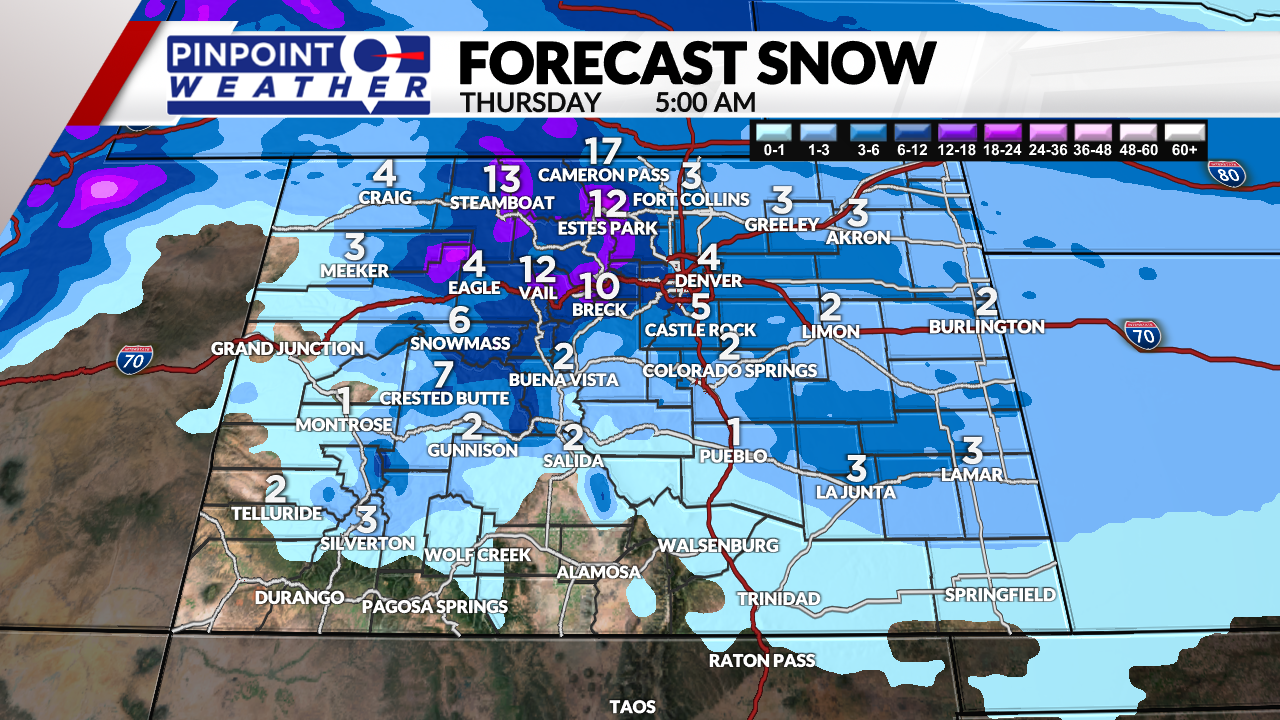
The next storm system spreads snow into the mountains by Tuesday afternoon/night, continues Wednesday and tapers off Thursday morning.
Snow hits Denver and the Interstate 25 corridor around 5 p.m. Wednesday and continues until midnight.
- Central and Northern Mountains: 6-14 inches
- Southern Mountains: 1-4 inches
- Denver: 1-4 inches
- Western Suburbs: 4-8 inches
- Foothills: 4-10 inches

It will turn much drier in Denver on Thursday as the storm system departs. Expect very cold temperatures near zero degrees in the morning.
Snow may linger in the mountains on Thursday and Friday with a northwest flow. This could add another 1-4 inches in the Northern Mountains.

It will be dry in Denver and across the Front Range on Friday through Sunday with highs in the 40s.

