DENVER (KDVR) — We are coming close to record heat this weekend with some isolated storms on Sunday.
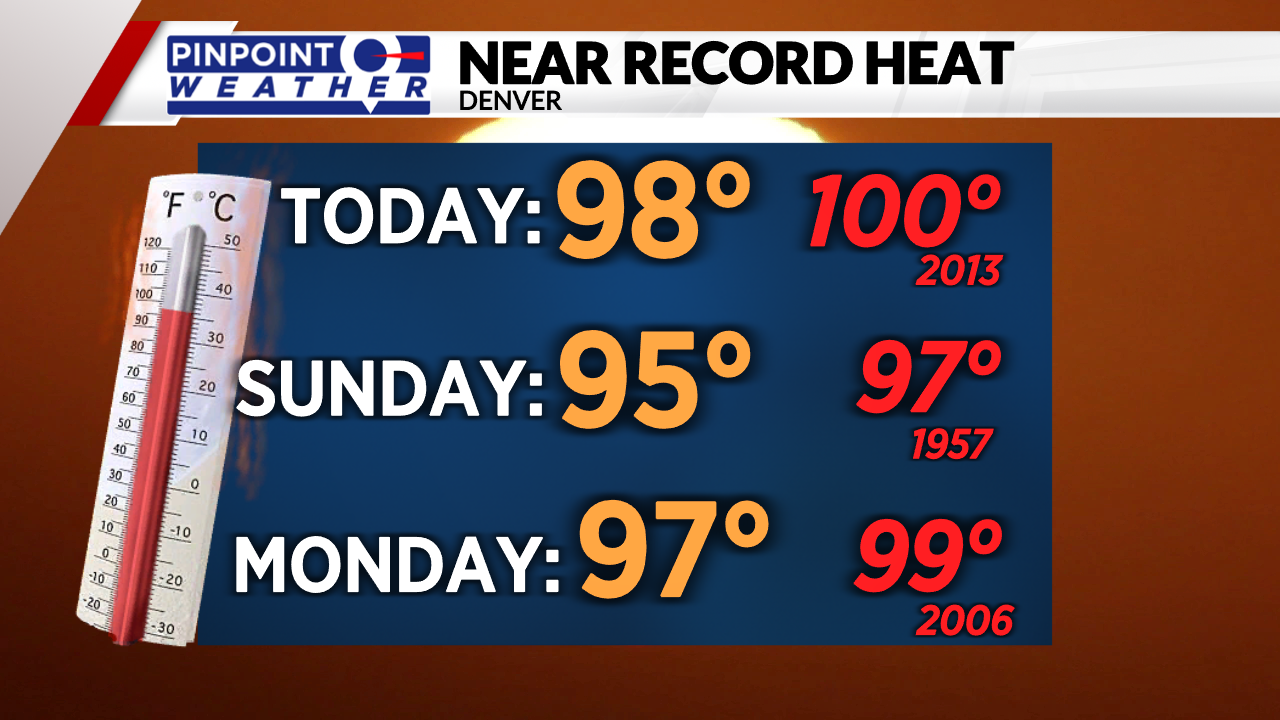
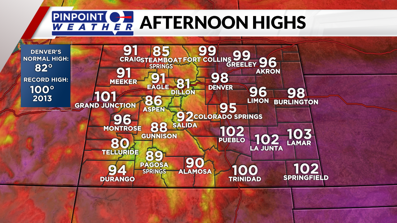
Saturday kicks off the hot weekend with morning sunshine and light winds. As temperatures climb into the upper 90s, a few clouds will build across the state and winds can become breezy in the afternoon.
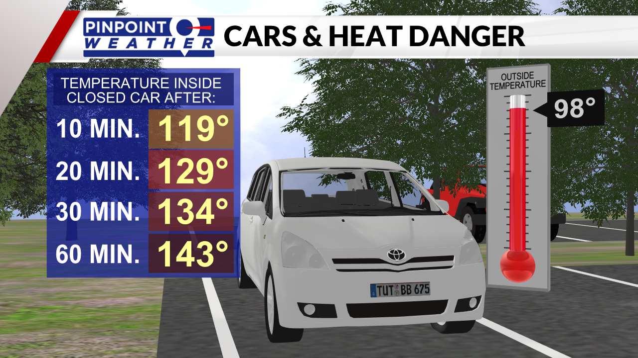
Take care out in the heat – lots of water, shade, and breaks! Do not leave kids, the elderly, or pets in the car, and watch out for hot pavement and playground equipment.
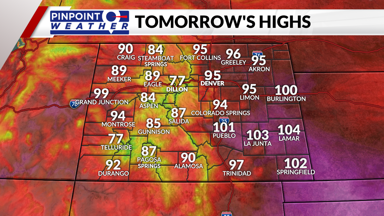
Sunday is staying hot with highs reaching into the middle 90s and late-day clouds. There is an isolated storm chance for the afternoon to evening, mainly the Eastern Plains will see activity.
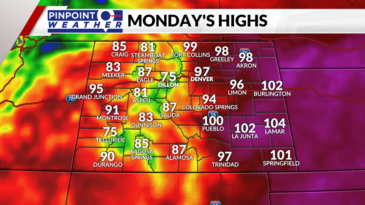
The high heat is still here for Monday with highs remaining in the mid-90s. Mostly sunny skies are expected with a windy afternoon which means high fire danger.
A boundary pushes through on Tuesday adding in a few extra clouds and the small chance for a late-day storm. Temperatures will be closer to seasonal averages as we top out in the mid-80s.

Highs stay in the 80s on Wednesday with clearing skies and a lighter wind. Then we are right back to the 90-degree heat.

