DENVER (KDVR) — A cold front swept through Colorado Sunday bringing cold temperatures for Monday and mountain snowfall.
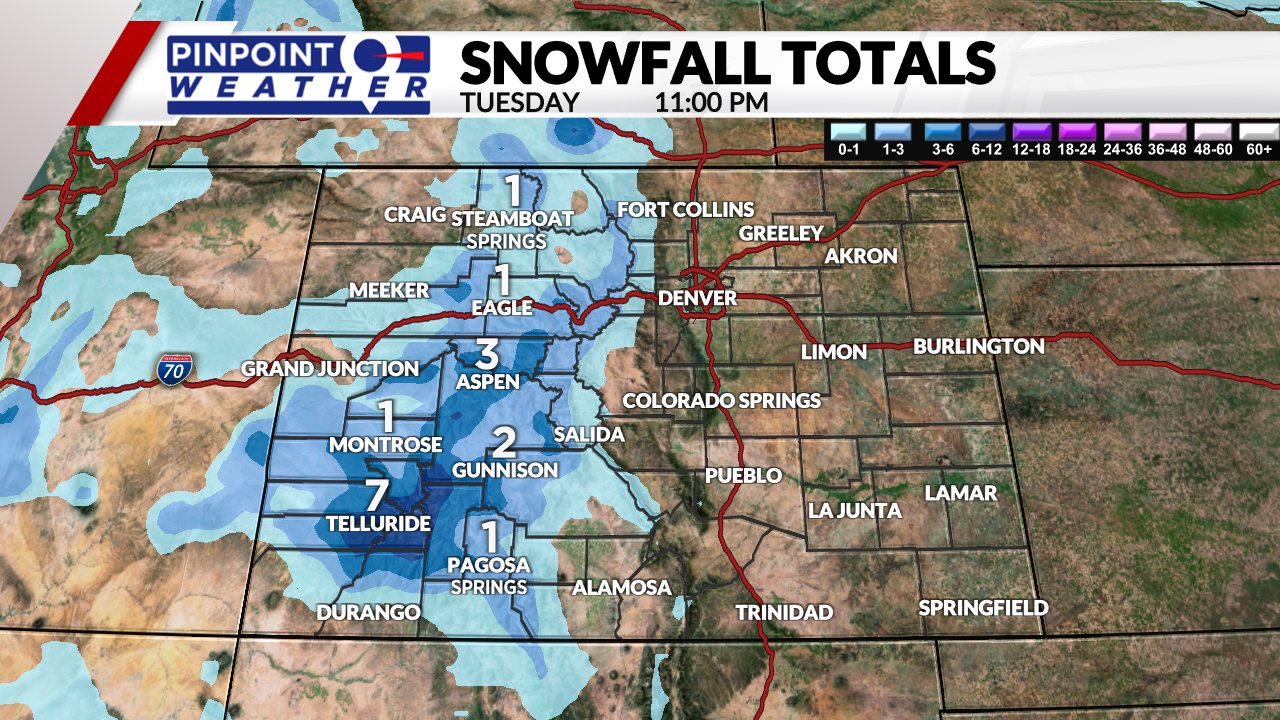
Mountain snow will continue overnight Monday and into the first half of Tuesday before clearing out. Totals are expected to range from 1-7 inches with the highest totals in the San Juan area.
Denver will heat up to the 50s on Tuesday with sunshine and dry conditions.

Wednesday and Thursday will stay mild for Denver and the Front Range before the next storm system moves in Thursday night.
This storm system will bring another round of mountain snow and will also bring the Front Range and lower elevations a snow chance.
It is possible that some showers start on the Front Range Thursday evening and continue into Friday. Temperatures will cool to the 30s on Friday as the storm moves through.
This system is still too far away to know exact totals but any accumulation on the Front Range is expected to be small at this time. It could finally bring the first measurable snow of the season to Denver.
Dry and cool weather will return for the weekend.


