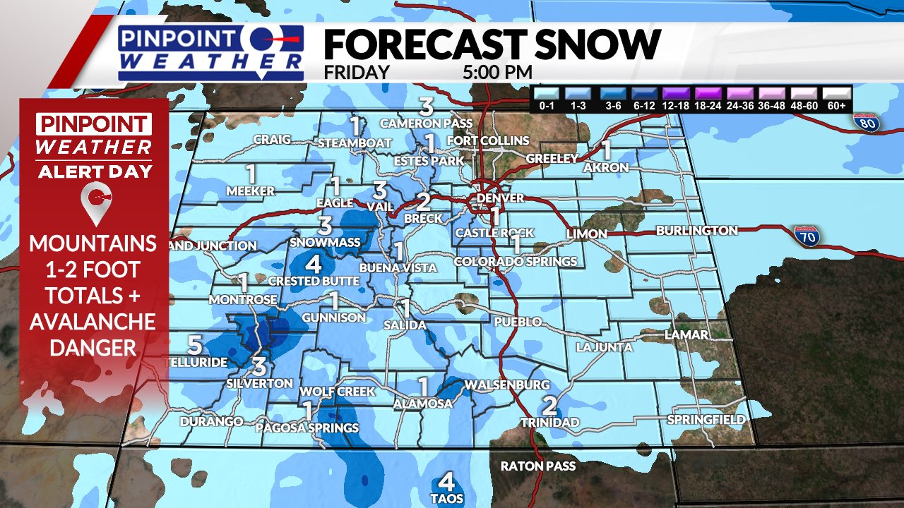
DENVER (KDVR) — We are forecasting an additional 1-6 inches of snow accumulation in the mountains on Friday before the storm system winds down. It will turn colder, with temperatures dropping into the teens. Overnight lows will be below zero degrees into Saturday morning.
Avalanche Warnings are in effect for most Western Slope Mountain Zones: south, central and north. The danger is rated at 4 out of 5.
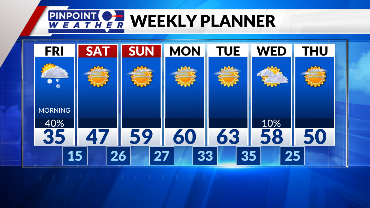
In Denver, there’s a chance for light snow during the morning rush hour, then it will be drier in the afternoon. Accumulation across I-25 should range from 0 to 1 inch. Expect colder highs in the 30s, which will fall into the 20s. Overnight lows will be near 10 degrees.
The Foothills could see 1-3 inches of accumulation Friday morning, then it will be drier in the afternoon.
It will be dry and sunny Saturday-Sunday statewide. Front Range highs will be in the 40s on Saturday and 50s on Sunday.
Next week features a storm system for the mountains between the 14th and 15th. There will be low chances of snow in Denver.


