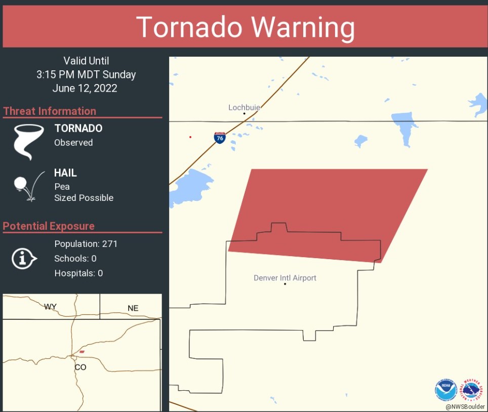
DENVER (KDVR) — A tornado warning was issued by the National Weather Service for Denver and Adams counties until 3:15 p.m.
A confirmed landspout tornado was seen near Denver International Airport at approximately 2:20 p.m.
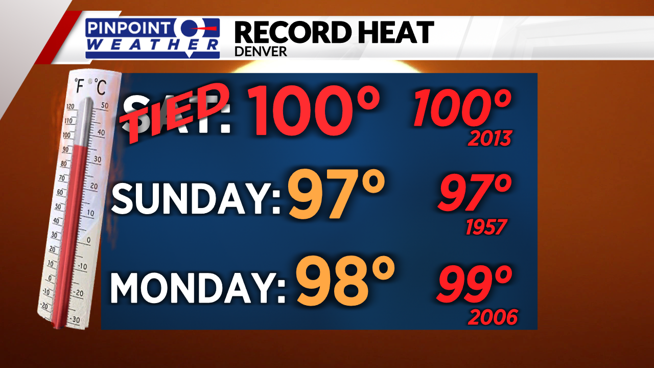
We started off the weekend by tying the record-high heat on Saturday of 100 degrees, and it’s possible again Sunday.
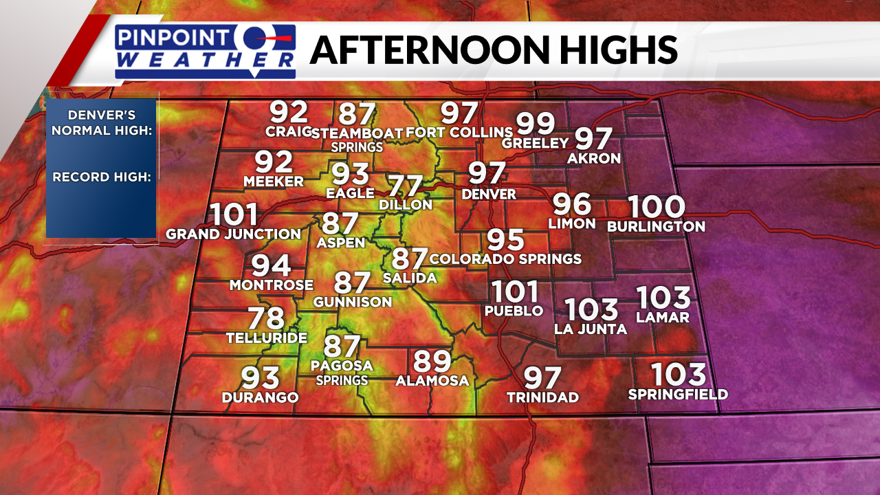
High heat continues Sunday with gusty winds by the afternoon and an isolated storm chance.
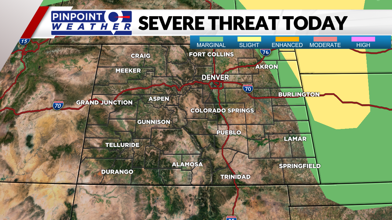
A few severe storms are possible this evening for the northeast plains, the main concerns are hail and gusts up to 60 mph.
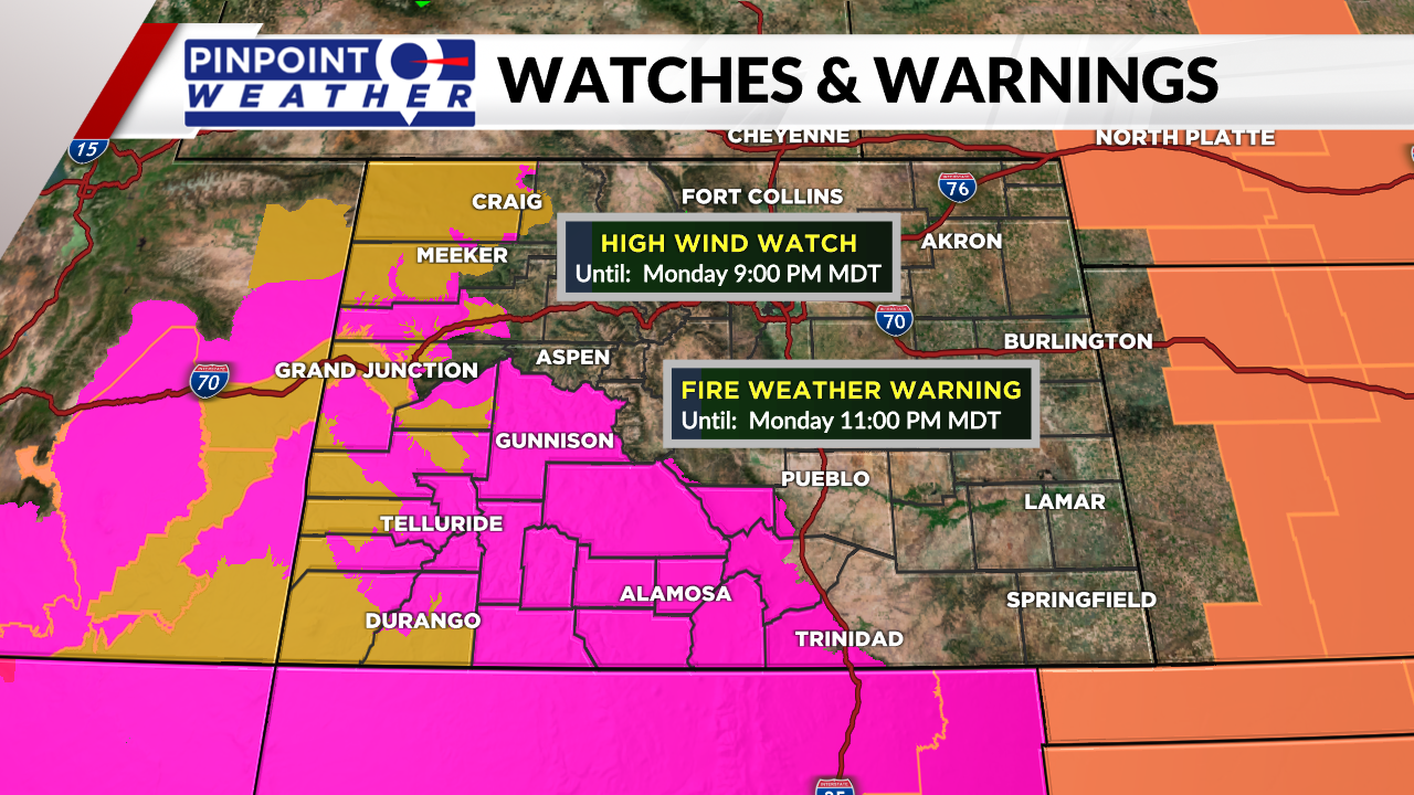
Monday has high heat and high winds which means high fire danger.

A cold front is coming and will move in early Tuesday, adding in extra clouds and the chance for a late-day storm. Highs are closer to seasonal averages in the middle 80s with a breezy wind.
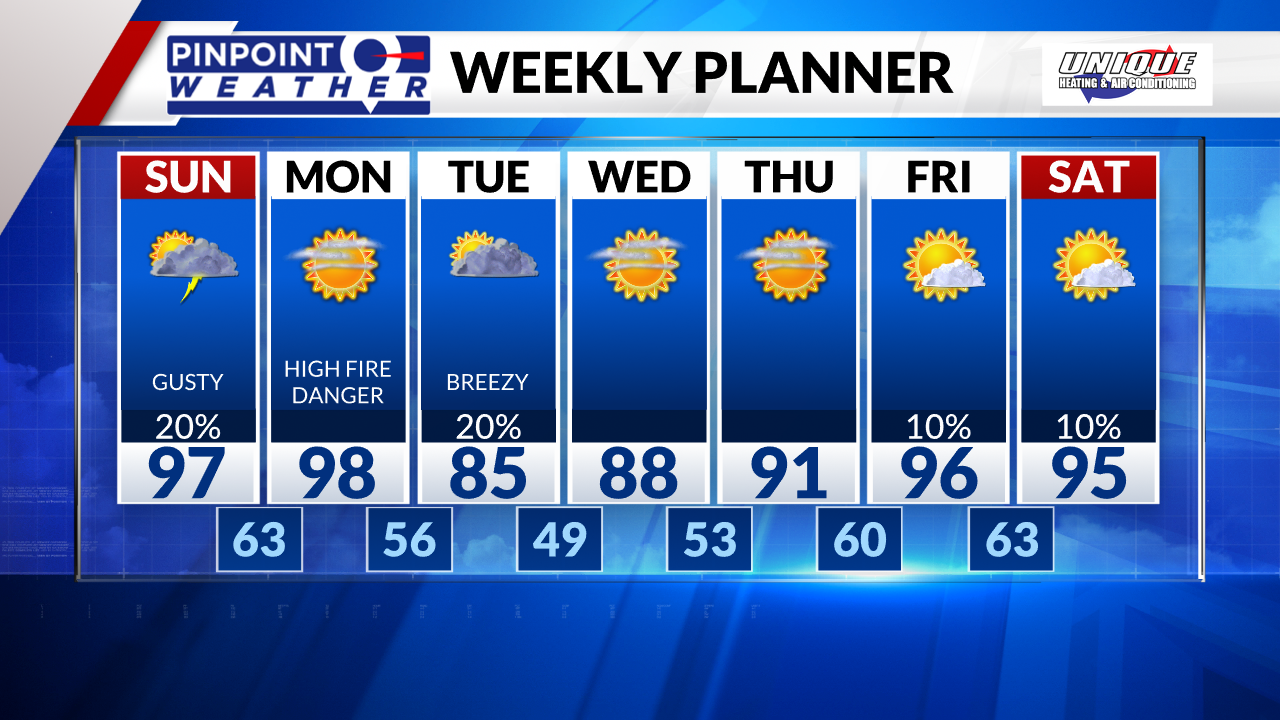
Wednesday is also in the 80s but we quickly start to heat things right back up to the 90s.

