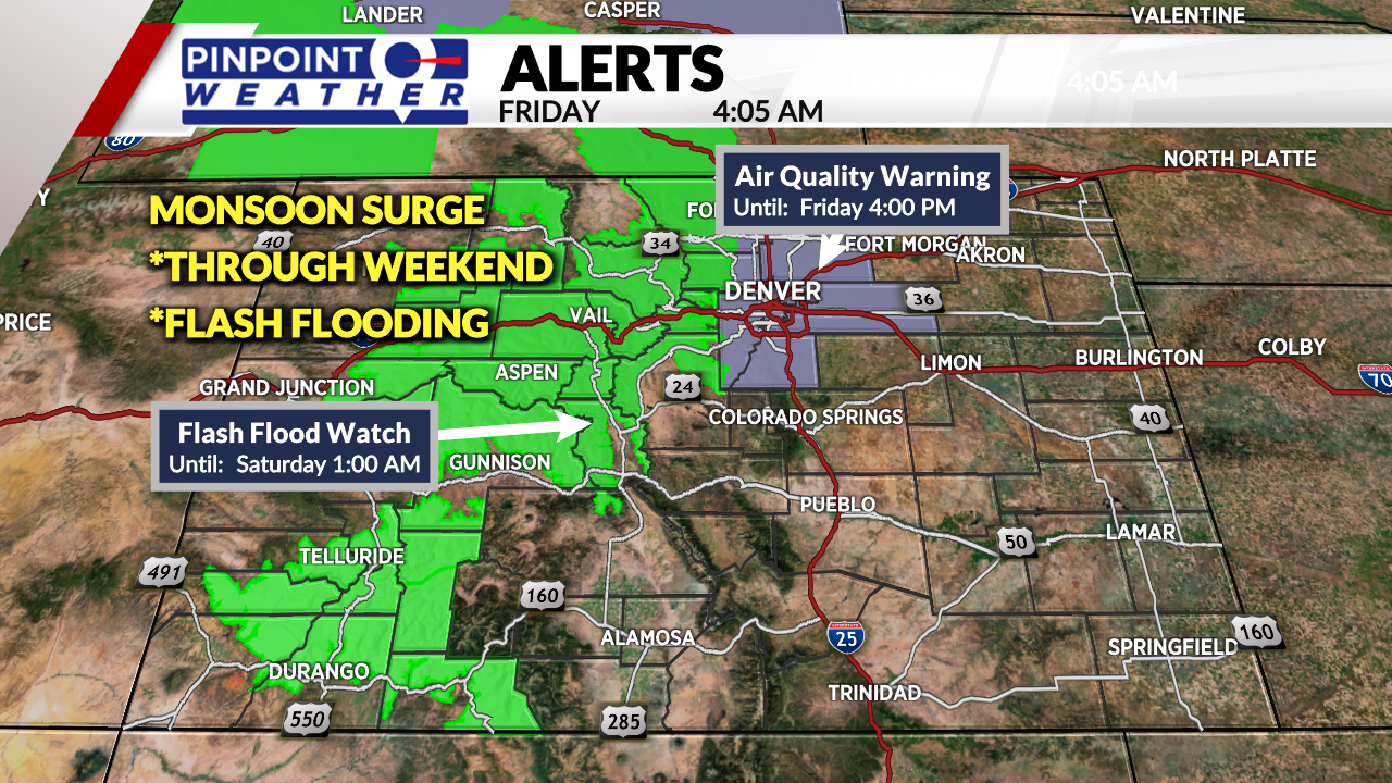
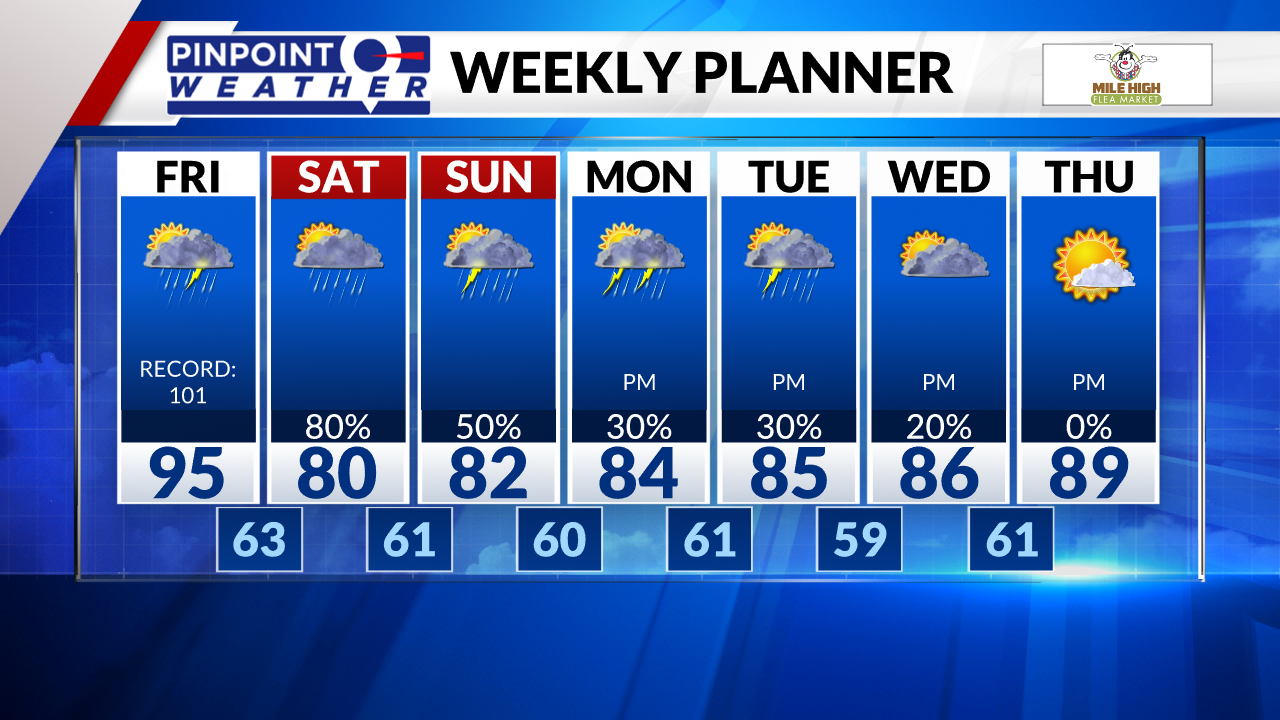
DENVER (KDVR) — Friday starts dry then afternoon thunderstorms develop over the mountains with flash flooding. The chance of t-storms in Denver occurs afternoon/evening with heavy rain and lightning potential. Front Range highs will stay hot in the mid-90s.
Around 4 p.m., the National Weather Service issued flash flood watches for the Interstate 25 corridor including the Denver metro area.
If you don’t have to travel, it is recommended to stay off the road. If you do, be aware of the dangers and what to do in the case of a flash flood. It is best to get to higher ground immediately and never drive through a flooded roadway. The saying “Turn Around, Don’t Drown” is a great message to keep in mind.
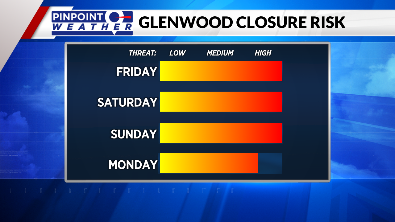
Flash Flood Watches are in effect for most mountain zones. Mudslides and road closures likely through the weekend. Glenwood Canyon will be closed all weekend.


There is a chance for heavy cloud cover and lingering drizzle in Denver on Saturday morning, then we’ll get a dry break before afternoon t-storms develop.
The highest chance for rain and flash flooding occurs Saturday afternoon and night across Colorado. One inch of rain in 30 minutes is likely with any thunderstorm. There’s a chance for flash flooding in Denver as well.
Cooler highs all weekend in Denver in the upper 70s and low 80s.
Clouds and drizzle may linger in Denver on Sunday morning then a dry break followed by a 50% chance of afternoon t-storms.
Dry Monday morning then a 30% chance of afternoon t-storms. Still high chances for flash flooding in the mountains.


