DENVER (KDVR) — The good news is there will be less wind overall Friday.
Gusts hit 115 mph at Rocky Flats on Thursday. Friday gusts will range from 10-25 mph from the west/southwest turning to the east in the afternoon behind a cold front.
This cold front opens the door for snow in Denver, Boulder, Loveland and Fort Collins on Friday afternoon. It could start by lunch in the western suburbs and even earlier in the foothills.
This cold front will significantly help the wildfire with less wind, higher humidity and eventually 2-8 inches of snow.
Snow timeline:
- Boulder: Snow by noon Friday until noon Saturday
- Denver: 4 p.m. Friday until noon Saturday
- Foothills: Snow by noon Friday until noon Saturday
Snow continues on Saturday morning before tapering off around lunch.
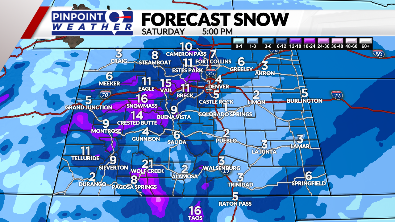
Total snow accumulation by 5 p.m. Saturday:
- Denver: 1-4 inches
- Boulder: 4-8 inches
- Fort Collins: 2-7 inches
- Greeley: 2-7 inches
- Castle Rock: 5 inches
- Foothhills: 4-12 inches
- Tunnel: 8-16 inches
- Summit County: 8-16 inches
- Western Slope ski areas: 10-24 inches
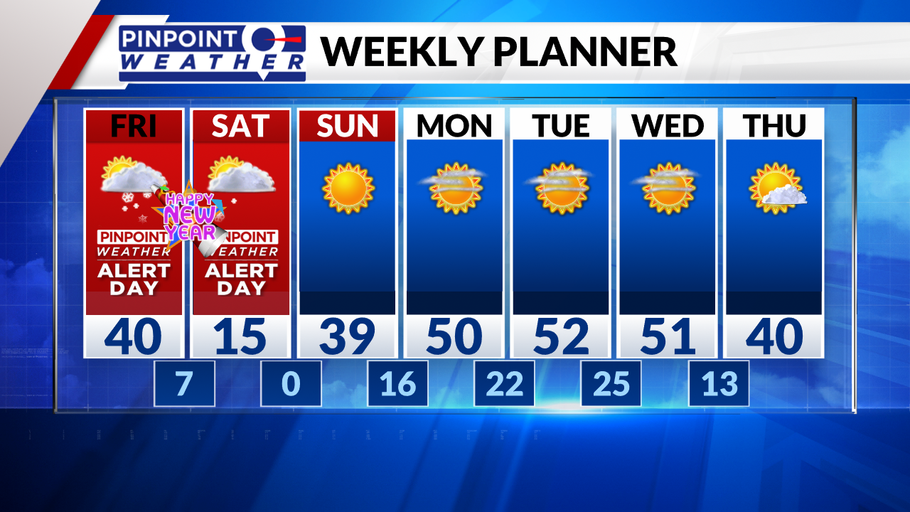
Overnight lows Saturday night into Sunday morning will drop to zero or colder in Denver and across the Front Range. Temperatures will fall to well below zero in the mountains.
It will be sunny and drier on Sunday with 40s.


