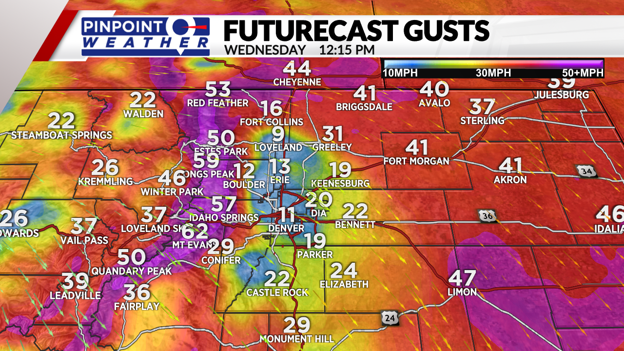
DENVER (KDVR) — The main storm system is exiting Colorado but leaving strong wind in its wake, especially in the mountains, Foothills, and parts of the Front Range and Eastern Plains. Blowing dust is possible.
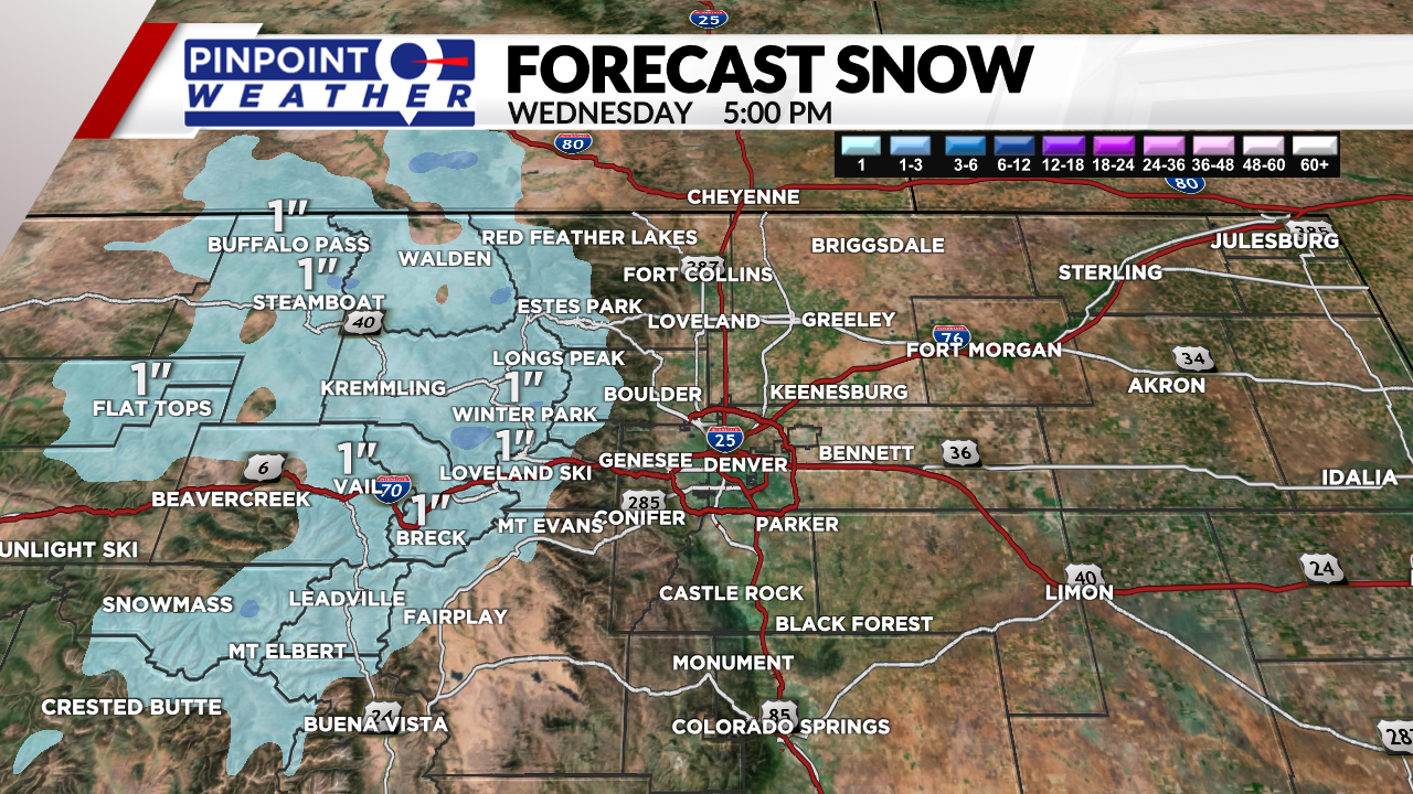
The mountains will see lingering snow showers along I-70 and north with 1-2 inches of additional accumulation.
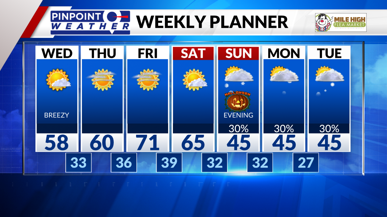
In Denver and across the Front Range, partly sunny skies, breezy northwest wind, and cooler highs in the upper 50s.
It will be dry Thursday through Saturday.
Halloween is trending colder with snow possible by 6 p.m. A cold front will race south from Wyoming across the Front Range. Wind also turns breezy during the afternoon as the front approaches. Expect colder highs in the 40s.
Light snow is possible into Monday with 1 inch of accumulation in Denver. Expect colder highs in the 40s and overnight lows in the 20s.