DENVER (KDVR) — The Pinpoint Weather Team is forecasting partly to mostly cloudy skies on Thursday in Denver and across the Front Range.
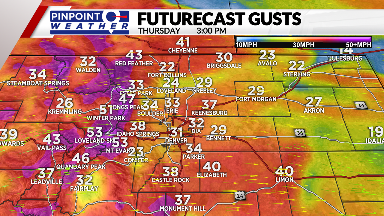
A gusty afternoon wind is ahead, hitting 15 to 35 mph. This wind brings high wildfire danger.
The NWS issued a red flag warning for the Front Range and eastern plains from 11 a.m. to 7 p.m.
On and off snow continues in the mountains with another 1 to 3 inches of accumulation on the high peaks and ski areas. Gusty wind ranging 30 to 60 mph and abnormally cold temps in the teens and 20s at ski areas.
Very similar conditions on Friday in the mountains.

In Denver, partly to mostly cloudy skies with less wind on Friday.
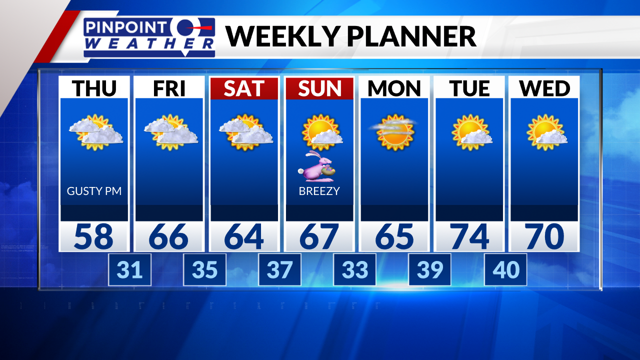
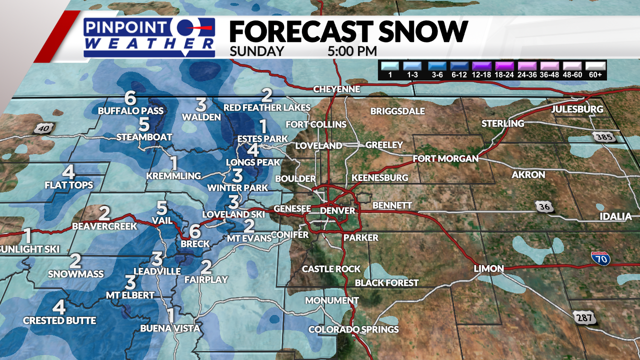
A new storm system will hit the mountains Saturday night into Easter morning. Another 2 to 8 inches of accumulation and a drop in temps. Gusty wind is likely.
Easter in Denver is expected to be partly cloudy with breezes around 15 to 35 mph wind and highs in the 60s.

