DENVER (KDVR) — A soggy storm system will deliver quite a bit of rain and snow to the northern Front Range through Wednesday.
The most impacted area through Tuesday evening will be the northeastern plains, where there’s an ongoing risk for severe weather.
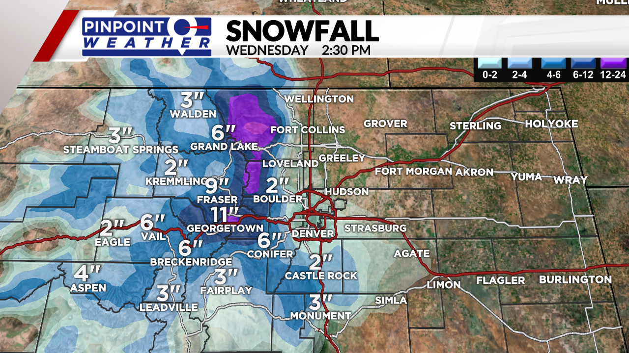
The bulk of the system will be rainfall for most metro locations, except those on the south and west sides of Denver. Those elevated locations will have a rain/snow to a snow event by Wednesday morning.

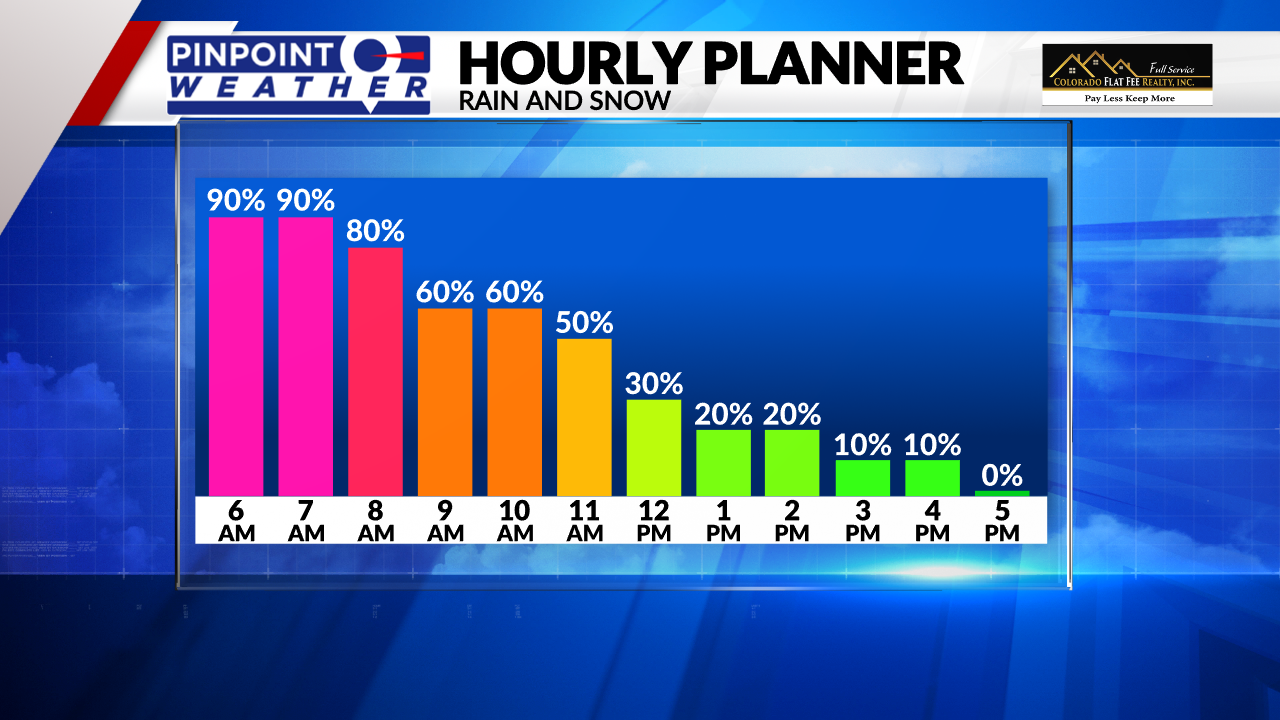
Tuesday evening into Wednesday morning will be the wettest period. Heavy snow will hit the foothills hard and cause slick roads after sunset. Heavy snow of a few inches could cause some tree damage south of downtown.

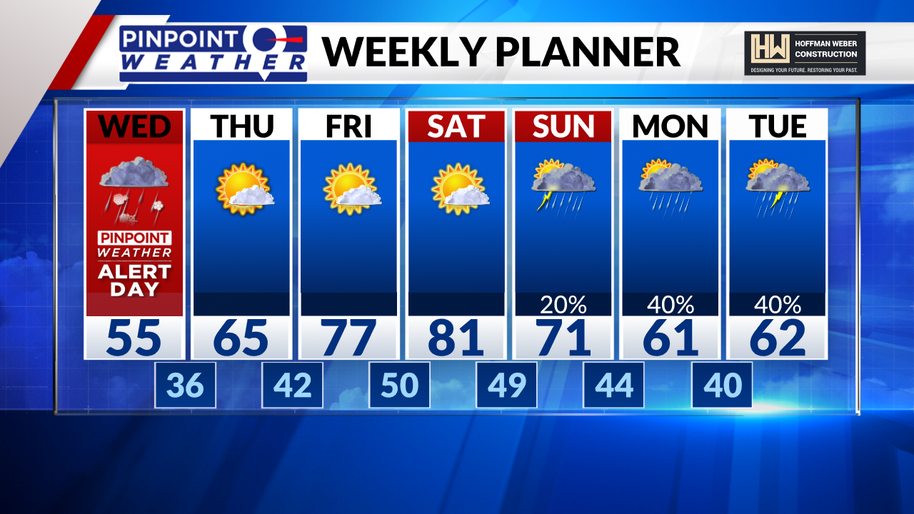
Conditions will gradually clear Wednesday, paving the way for quite a warm-up headed into the weekend. Roads will be slushy and sloppy for the morning drive, especially south of the city and in the foothills to the west.


