DENVER (KDVR) — The Pinpoint Weather Team is forecasting a 10% chance of an afternoon rain shower/gusty t-storm across the Front Range on Tuesday with highs in the mid-80s.
In the mountains, morning sunshine gives way to a 10-20% chance for a rain shower/t-storm. Highs will be in the 60s.
Wednesday features a 20% chance of afternoon rain/t-storms in Denver.
Expect afternoon wind on Thursday with gusts from 20-45 mph and highs near 90 degrees. The record high is 91 degrees.

A strong cold front races down the Front Range early Friday with temperatures falling 40 degrees from Thursday’s 90-degree high temperature.
After 10 a.m. a rain/snow mix will develop in Denver. Expect lots of melting. It will be all wet snow west and south of Denver. Expect several inches of heavy, wet snow above 6,000 feet. The Foothills and Divide could get 4-10 inches of accumulation.
The Pinpoint Weather Team has issued a Pinpoint Weather Alert Day for Friday.
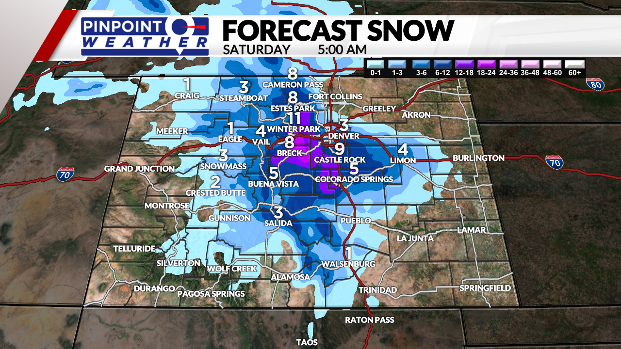

Skies might clear early Saturday with overnight lows around freezing in Denver. This could result in a frost/freeze situation.
It will turn sunny on Saturday with highs in the 50s. Sunday looks dry with temperatures warming back into the 70s.

