DENVER (KDVR) — We are forecasting cloudy skies today with a few breaks of sun and a 30% chance of rain and/or snow showers. Highs will be around 43 degrees.
The mountains can expect a 50% chance of snow with light accumulations. Highs will be in the 20s, 30s, and low 40s.
Light snow arrives in Denver by Saturday morning. A rain/snow mix may also affect the Front Range and certainly the Eastern Plains.
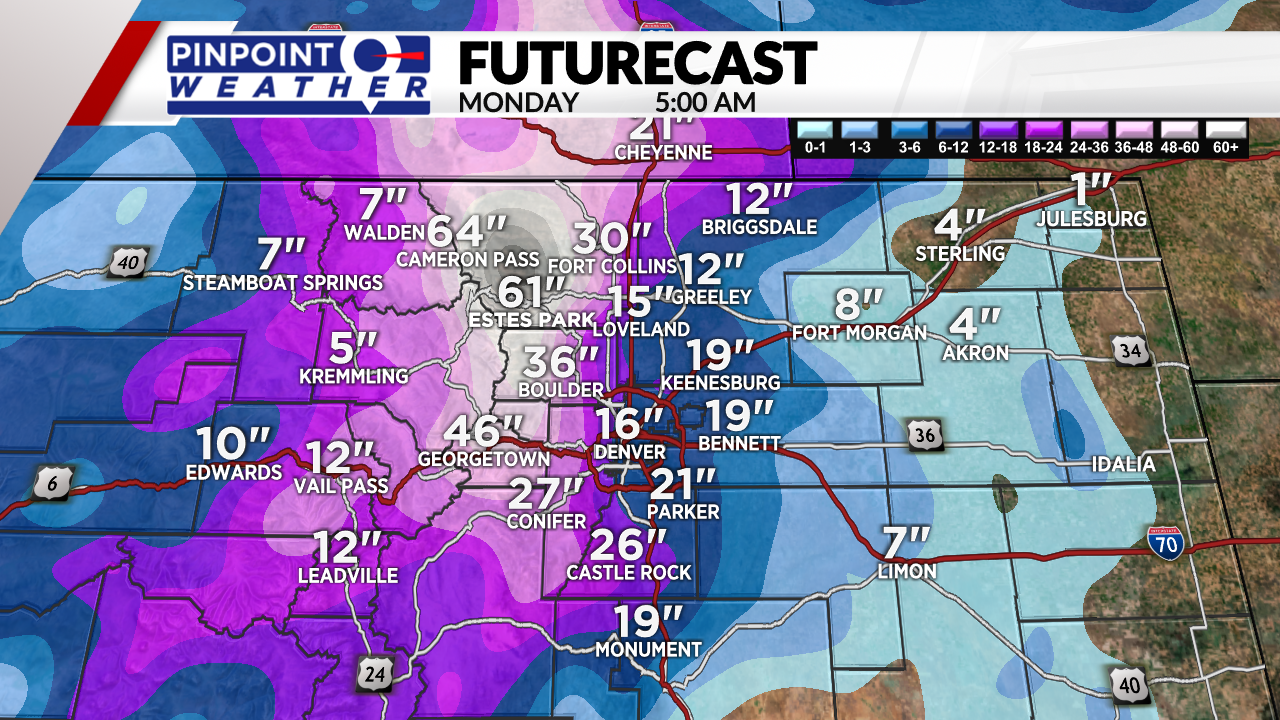
The heaviest snow arrives Saturday afternoon through Sunday. The snow winds down by Monday morning.
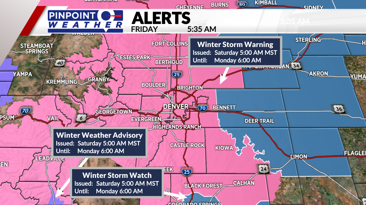
One thing to watch is the rain/snow line on Saturday. Rain could mix into the snow in Weld County and near DIA cutting down on total snow accumulation. The Eastern Plains will be primarily a mix with less snow accumulation.
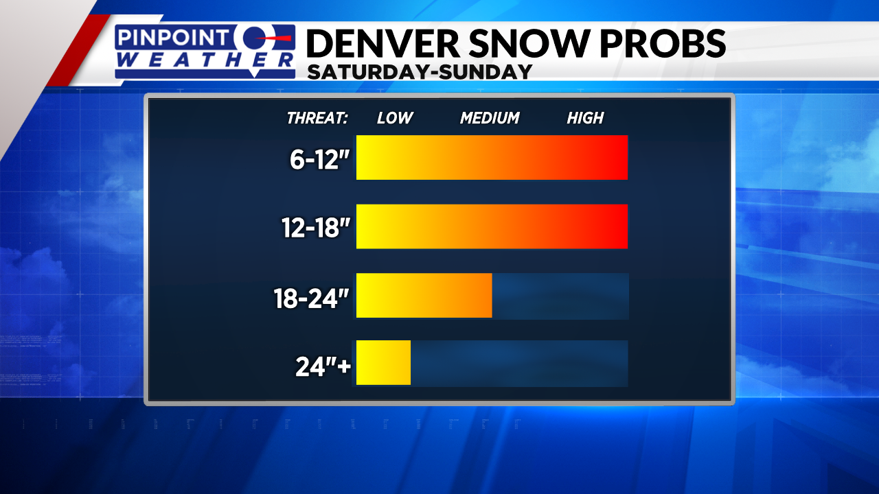
One to two feet of snow accumulation up and down the I-25 Corridor. That includes Denver, Fort Collins, Loveland, Castle Rock, and Highlands Ranch.
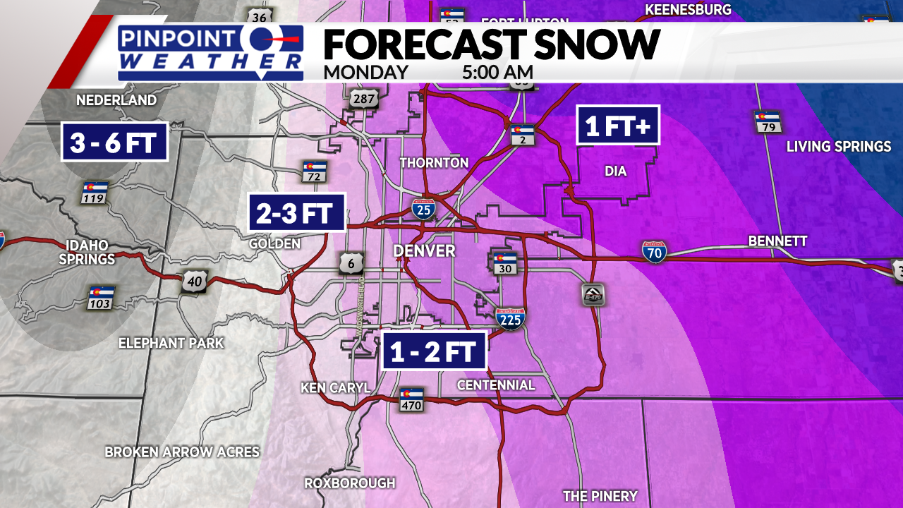
Two to three feet of accumulation possible in the western suburbs and Foothills. Three feet or more possible in the Foothills and near the Divide. There is a bullseye in Larimer and Boulder Counties where 4-6 feet is possible.
Be sure to download the free Pinpoint Weather App to stay updated on the latest developments with this storm.