DENVER (KDVR) — It will be another day near 60 degrees with partly sunny skies. Conditions will turn mostly cloudy this afternoon.
The mountains stay partly to mostly cloudy Tuesday with mild temperatures in the 30s and 40s.
The Pinpoint Weather Team issued a Pinpoint Weather Alert Day ahead of Wednesday’s snowstorm.
Here’s a look at when snow will start on Wednesday:
- Central and Northern Mountains: Early Wednesday
- Northern Colorado: 7 a.m. or later
- Boulder: 12 p.m.
- Denver: 12 p.m.
- Castle Rock: 12 p.m. or later
The Wednesday evening commute will be the most impacted by the snowstorm.
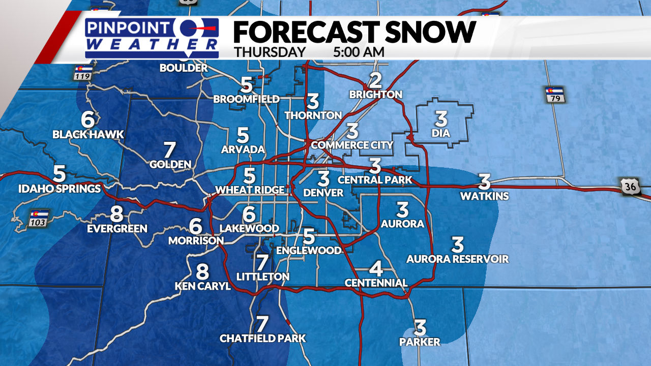
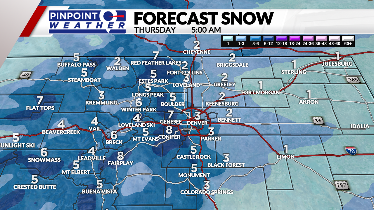
Here’s a look at how much snowfall is expected:
- Denver: 2-4 inches
- Fort Collins: 2-4 inches
- Eastern Plains: 1-3 inches
- Foothills: 4-8 inches
- Mountains: 4-10 inches
- Palmer Divide: 3-6 inches


Skies will clear on Thursday with highs in the 30s and 40s.

It will be dry on Friday through Sunday with highs in the 50s.
The next storm system arrives Monday-Tuesday bringing another round of snow.
As the storm moves in, the Pinpoint Weather Team will further break down expected snowfall totals.
- Closings & Delays: Full List
- Interactive Radar
- Delays and cancellations at Denver International Airport
The Pinpoint Weather Team will continue to update the forecast multiple times each day. Be sure to download the free Pinpoint Weather App to stay up-to-date with the newest data as it comes in.

