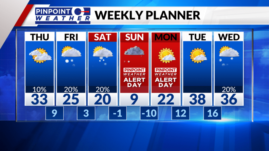
DENVER (KDVR) — Once again we are stuck in the fog, freezing fog, flurries, and dirty polluted air. Cold highs around 33 degrees in Denver, Boulder, Loveland, and Fort Collins.
The mountains can expect a 30% chance of snow showers today. Highs in the 20s and some 30s.
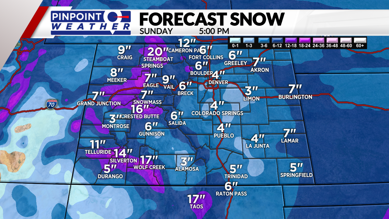
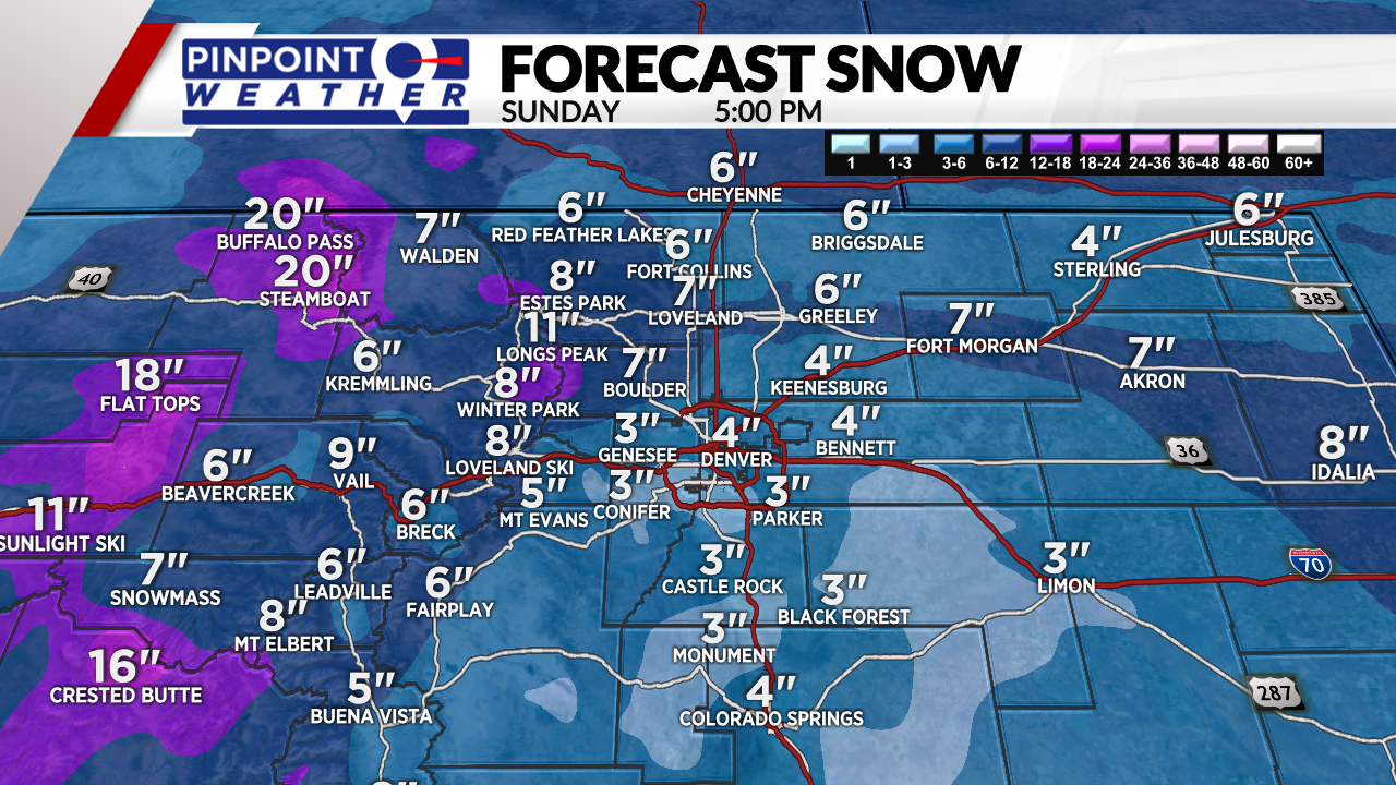
Two storm systems are lined-up between Friday-Sunday. The first storm system arrives Thursday night through Saturday morning. 3-8 inches of mountain snow. The most falls around Steamboat and Cameron Pass, with 12 inches possible. Colder temps.
A few snow showers possible in Denver with light accumulations mainly north of Denver.
The second storm system arrives Saturday afternoon through Sunday afternoon. 4-8 inches of mountain snow with the heaviest pockets around Steamboat, Cameron Pass, Flat Tops, Crested Butte and Aspen/Snowmass. 12 inches possible there.
We are forecasting 2-6 inches in Denver on Sunday. This also includes most of the Front Range. An early high of 10 then then falling to zero late in the day.
We’re now forecasting a low of minus 10 that night into Monday morning in Denver and across the Front Range.
Be aware that snow will remain on the roads for the Monday morning rush hour. We’ve issued a Pinpoint Weather Alert Day for Sunday and Monday.