DENVER (KDVR) — Denver’s weather will stay warm and dry before big changes on Sunday.
Sunday’s storm system will likely bring the first freezing temperatures of the season to metro Denver and the first impactful snowfall to parts of Colorado’s mountains.
Weather tonight: Perfect patio weather
For the third day in a row, temperatures hit the upper 70s in Denver on Friday afternoon. The evening will stay warm and dry with increasing clouds.
A fire weather warning is in place for parts of the northern Front Range until 6 p.m. tonight. Winds will decrease after sunset.
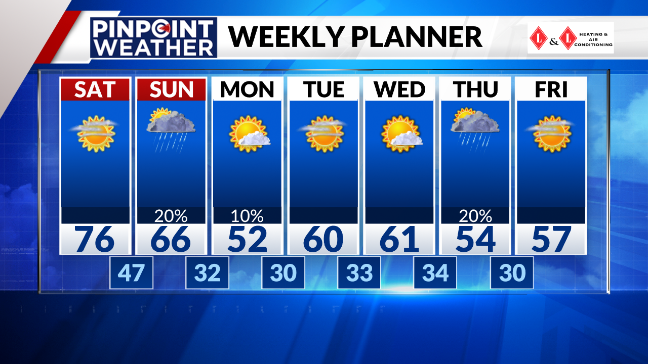
Overnight low temperatures will fall to 46 degrees in Denver to start out Saturday.
Weather tomorrow: Fire danger before changes
Mild weather will last into Saturday with high temperatures reaching 76 degrees. Denver and the Front Range will stay dry and breezy.
There will be high fire danger to the south and east of metro Denver, where a fire weather warning is in place through 7 p.m. On the plains, winds will gust up to 35 mph.
Looking ahead: Snow on Sunday
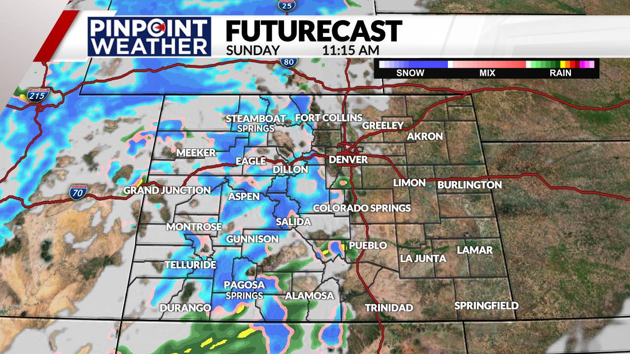
Colorado’s next storm system will move in from west to east. Precipitation will start late Saturday night on the Western Slope and continue to spread east throughout Sunday.
The mountains, especially areas west of the Continental Divide, will see the heaviest snowfall. Although most of the precipitation stays in the mountains, a few showers will spill over onto the Front Range, plains and foothills on and off on Sunday.
Sunday will be breezy to gusty across the state as the storm system pushes in.

Not all lower elevations will see precipitation with a shower chance of only 20%, but areas that do will likely see it fall as rain around metro Denver.
There is potential for some snow to mix in with rain west and south of Denver for the foothills and Palmer Divide. If there is any accumulation in these areas, it will stay under an inch with melting expected.

Colorado’s western mountains will see 4-10 inches of snow with about 2-6 inches for places along and east of the divide. Prepare for winter weather driving conditions in the mountains if you are traveling on Sunday.
On the Front Range, high temperatures will fall to the 60s on Sunday with the incoming storm and to the 50s by Monday.
Overnight low temperatures have the potential to fall below freezing for the first time this season Monday and Tuesday mornings. Make sure to drain your outside pipes for this storm. You can hold off on blowing out your sprinklers in Denver, as it will not be a hard freeze yet.

Monday will be mostly dry in the lower elevations with a few lingering showers in the mountains. Sunshine and 60s move back in Tuesday and Wednesday.
Colorado’s next storm system moves in on Thursday, bringing cooler temperatures and a chance of rain to Denver.

