DENVER (KDVR) — Temperatures will drop and snow moves in Monday night through Tuesday for Denver’s weather. The northeastern plains are expected to be the most impacted prompting the Pinpoint Weather Team to issue a Pinpoint Weather Alert Day for Tuesday.
Weather tonight: Dry, mild lows
Denver and the Front Range will remain dry through Sunday night with high cloudiness. Lows around 33-35 degrees are expected.
The mountains can expect snow across the Western Slope by Monday morning.
Weather tomorrow: Sunny early before clouds increase
It will be sunny in Denver early Monday with clouds increasing in the afternoon. It will turn breezy and temperatures will drop with afternoon gusts of 15-30 mph.
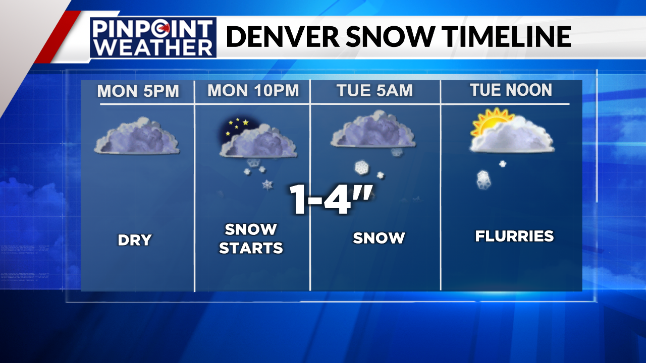
Snow develops around 9-10 p.m. and continues off/on through the Tuesday morning rush hour.
Snow will continue to spread west to east through the mountains with 2-6 inches of accumulation expected. Wind above the treeline increases to gusts of 20-50 mph.
Pinpoint Weather Alert Day Tuesday: Plains most impacted
Tuesday is a Pinpoint Weather Alert Day as snow continues off/on in Denver and across the Interstate 25 corridor with 1-4 inches of total snow accumulation. Air temps turn colder in the 20s and 30s.
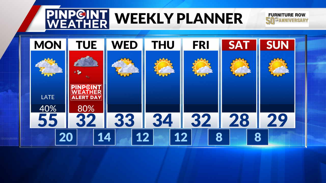
The bullseye appears to be the northeastern plains and Interstate 76 corridor, where 4-12 inches of snow and wind gusts of 40-60 mph are possible. This will likely generate whiteout conditions and blizzard conditions are possible with road closures.
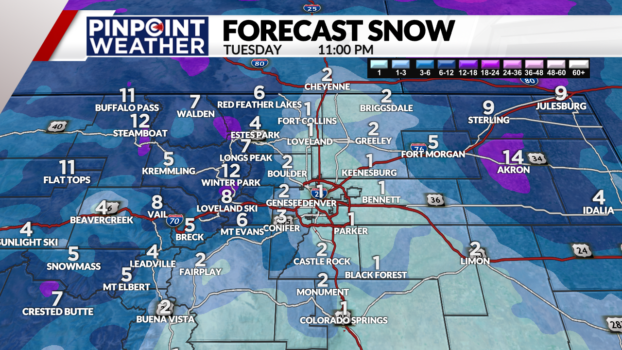
Snow tapers off in Denver midday Tuesday into the afternoon. But it will continue to snow in the central and northern mountains and across the northeastern plains, with another 2-6 inches possible in the mountains.
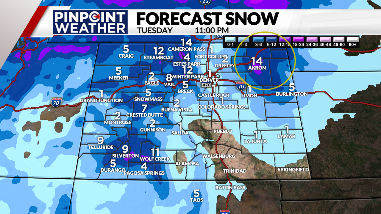
Mountain snow will continue in the central and northern zones with another 3-8 inches Wednesday through Thursday before ending. Some places could end up with 1-2 feet of total snow accumulation by Thursday.

