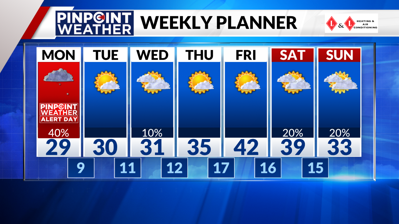
DENVER (KDVR) — Denver’s weather will turn snowy once again Monday morning as a weak storm system pushes across the state.
Totals will be small with this storm system but it could be just enough snow to cause problems for the Monday morning commute.
Weather tonight: Snow develops
In Metro Denver and along the Front Range, snowfall will develop after 1 a.m. Monday morning. Snow showers will increase in coverage by early Monday morning.
Temperatures will hit the teens along the Front Range overnight.
Weather tomorrow: Morning show showers

The Front Range will see scattered snow showers throughout Monday morning with most of the showers ending by midday. There will only be a 10% chance for snow showers after noon meaning most places will be dry in the afternoon and evening.
The biggest travel impacts will be Monday morning. Slick spots are possible especially south and west of Metro Denver.
Some places on the Front Range won’t see accumulation from showers but areas that do see snow will likely keep totals under an inch. The Palmer Divide and foothills could see up to 2 inches under heavier showers.
Parts of the southwest mountains will see 2 to 8 inches of snow.
Looking ahead: Chilly week ahead
Dry weather and sunshine will return on Tuesday with a high temperature of only 30 degrees.

There will be a 10% chance for an isolated shower on Wednesday. Temperatures will stay in the chilly 30s through Thursday.
Both Saturday and Sunday of next weekend will have a 20% chance for snow showers.

