DENVER (KDVR) — High winds are back across Denver on Friday, meaning there is enhanced fire danger along the southern Front Range and southern Eastern Plains from noon through 7 p.m. in the Denver weather forecast.
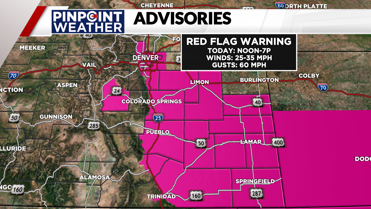
Weather today: Red flag warnings
Friday has a mix of sun and clouds with below-average highs in the middle 50s. High winds are back and coming out of the northwest at 25-35 mph with gusts up to 60 mph this afternoon.
With dry conditions, there is an enhanced fire danger Friday.

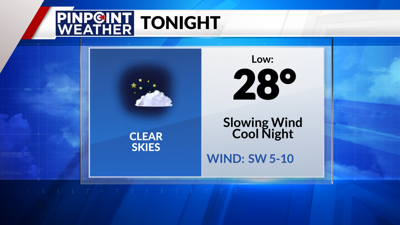
Weather tonight: Slower winds, cool
Skies will slowly clear overnight Friday with lighter winds. Overnight lows will dip into the upper 20s with a southwest wind at 5-10 mph.
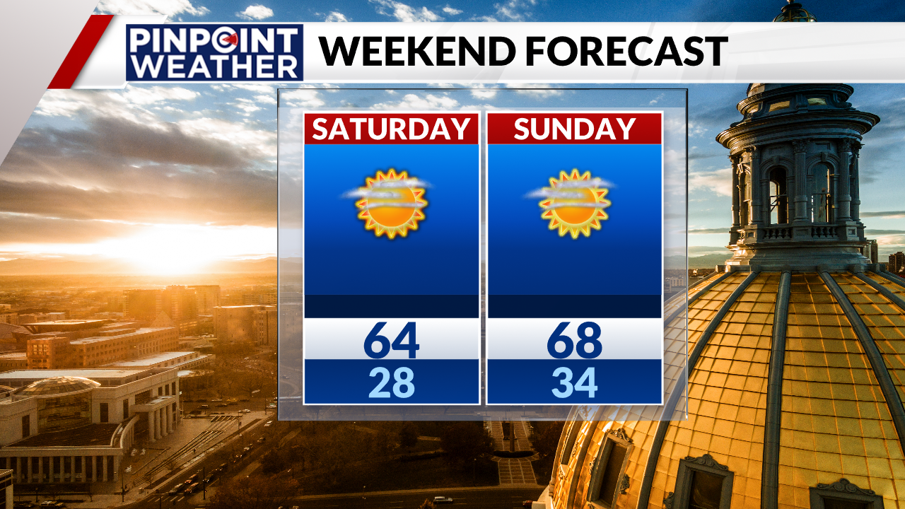
Looking ahead: Nice weekend, snow and rain ahead
The weekend ahead looks great with mostly sunny skies and warm temperatures. Denver will be above average with temperatures in the mid-60s on Saturday and nearing 70 degrees on Sunday.
Monday kicks off the workweek with a few extra clouds and comfy highs in the middle to upper 60s.
The clouds build ahead of some rain and snow chances on Tuesday. Temperatures will dip all the way into the middle 40s with brisk winds.
Extra clouds stick around on Wednesday with cool highs in the low 40s.
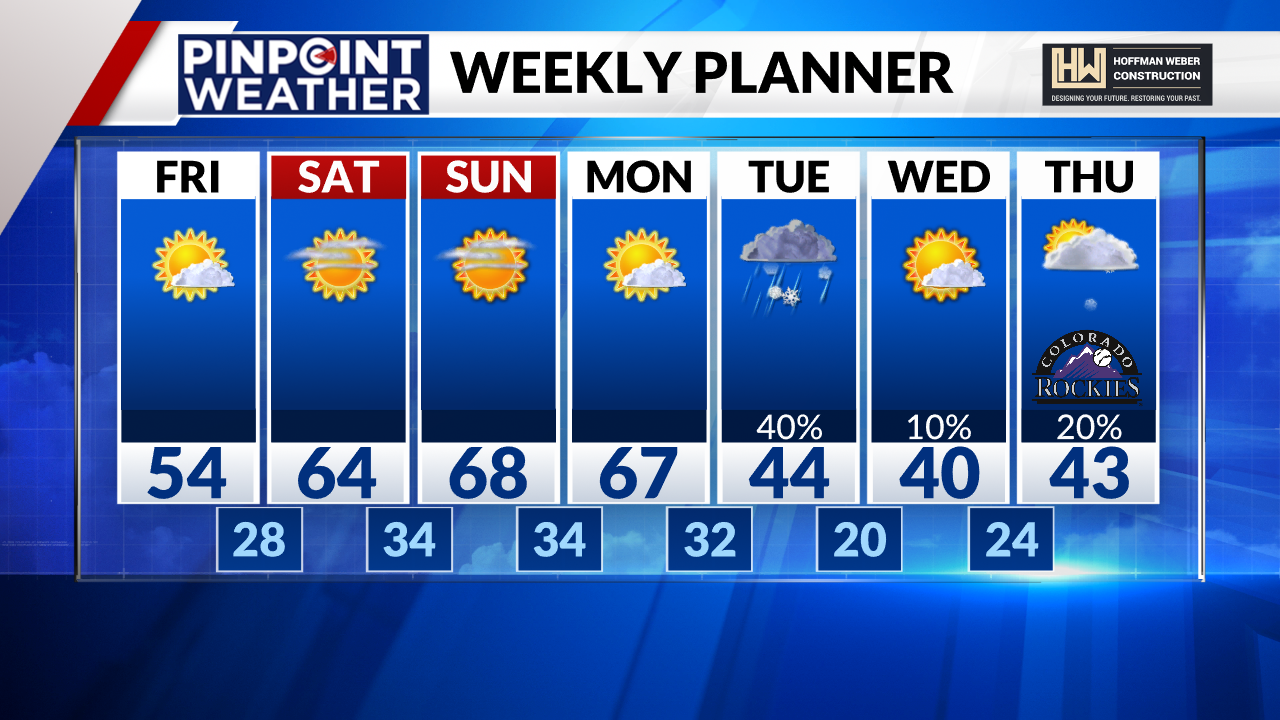
The Rockies’ home opener on Thursday will be chilly in the lower 40s with chances for rain and snow.

