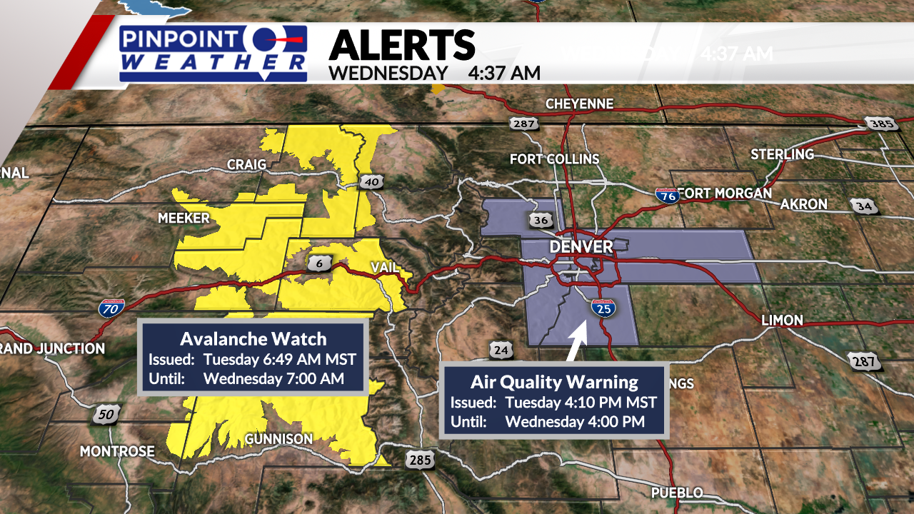
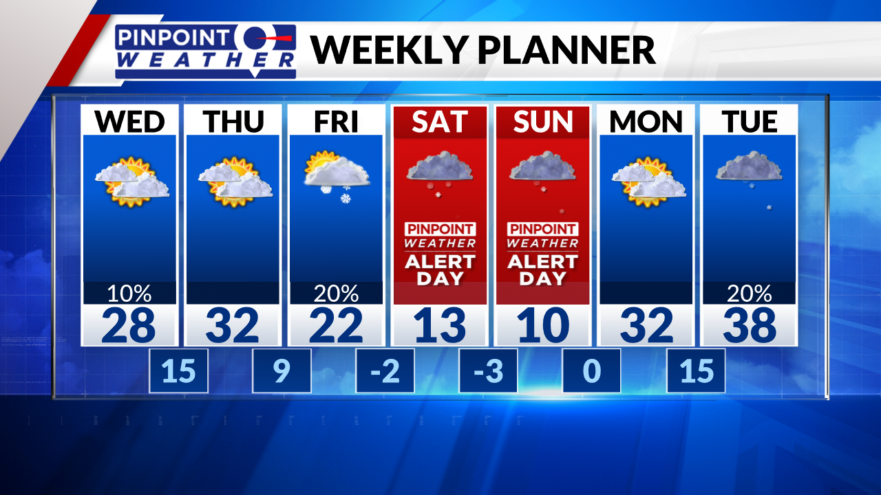
DENVER (KDVR) — We are forecasting a continuation of the temperature inversion for Denver and the Front Range. Fog, flurries, and dirty polluted air. Highs in the 20s.
The mountains can expect lingering snow showers today and Thursday. Another 1-2 inches of accumulation.
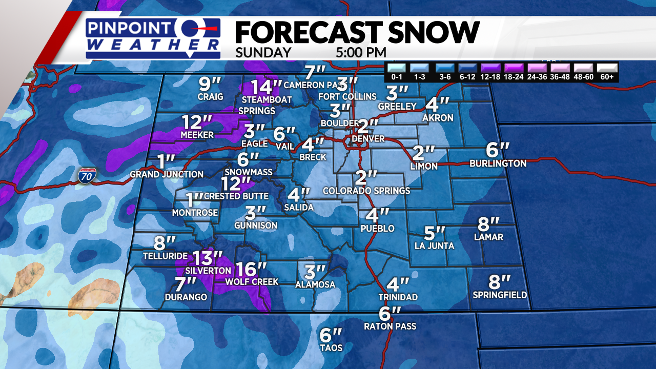
A larger storm system arrives on Friday. 3-8 inches of mountain snow or more. 1 inch or less in Denver.
A 2nd storm system arrives on Saturday night into Sunday. Another 3-8 inches of Mountain snow. 1-4 inches across the Front Range including Denver.
Colder highs both Saturday and Sunday. 10-15 degree highs both days in Denver, Boulder, Loveland and Fort Collins.
We’ve made both Saturday and Sunday Pinpoint Weather Alert Days for cold and snow.
Drier on Monday.