DENVER (KDVR) — A major cold front is heading toward the Front Range, and it gets here Monday night. After a near-record hot day in the low to mid-90s, the leading edge of the cold air slams into Colorado after dinner, producing wind gusts past 40 miles per hour. The temperature will drop into the mid-30s by daybreak Tuesday, where it will remain all day.
Winter Storm Checklist for Colorado

We have issued a Pinpoint Weather Alert Day for Tuesday and Wednesday due to an impending Winter Storm.
Rain will develop around midnight, but change to snow by daybreak tomorrow. Snow will accumulate to between 1-3 inches in Denver on grassy and elevated surfaces, roads will remain wet.

Snow will melt on contact thanks to the heat retained in the asphalt as well as a summer sun angle, bombarding the pavement with solar radiation to keep it warm.
In the mountains, snow could amount to greater than a foot, where roads could become snowy, especially above 10,000 feet. The snow will continue Tuesday night, but taper by daybreak Wednesday.
Tuesday night, temperatures will dip into the upper 20s to near 30 degrees in Denver with single digits and teens in the mountains. This could lead to a few slick spots for the Wednesday morning commute across the region.
Monday will bring another day of temperatures in the 90s, which will tie the record for most recorded 90 degree days in a year at 73 days.
Accumulation:
- 1-3 inches for Denver
- 4-6 inches for the Palmer Divide
- 7-11+ inches for the Foothills and mountains
The last measurable snow in September was on September 24, 2000.
The snow is great news as far as fire-fighting efforts go, reducing its footprint and impacts. The Cameron Peak fire burning out of control, in western Larimer County, will likely continue to grow today.
It has expanded to greater than 50,000 acres and with winds gusting past 50 mph Monday afternoon and it could explode in to a much larger fire later today.
So far, the fire has sent smoke and falling ash all the way into Denver with soot and burnt pine needles visibly accumulating on parked cars.

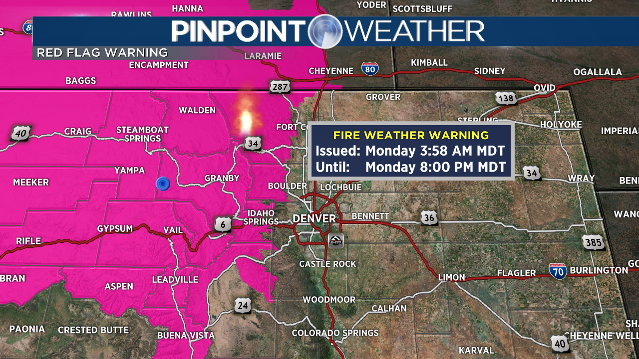
This may continue today as the wind direction remains the same. However, starting tonight, the area should get between 6-12 inches of snow with temperatures falling in the 20s. This should significantly reduce its ability to spread, and it may shrink considerably. But do keep in mind, until the cold front hits, fire weather remains extreme Monday.
There is a Red Flag warning for the high county and with gusty winds and low humidity this afternoon, the fires may spread explosively, as they did this weekend.

There is a Winter Weather Advisory in effect for Denver from midnight tonight until Noon Wednesday. There is a Winter Storm Warning for the High Country.

