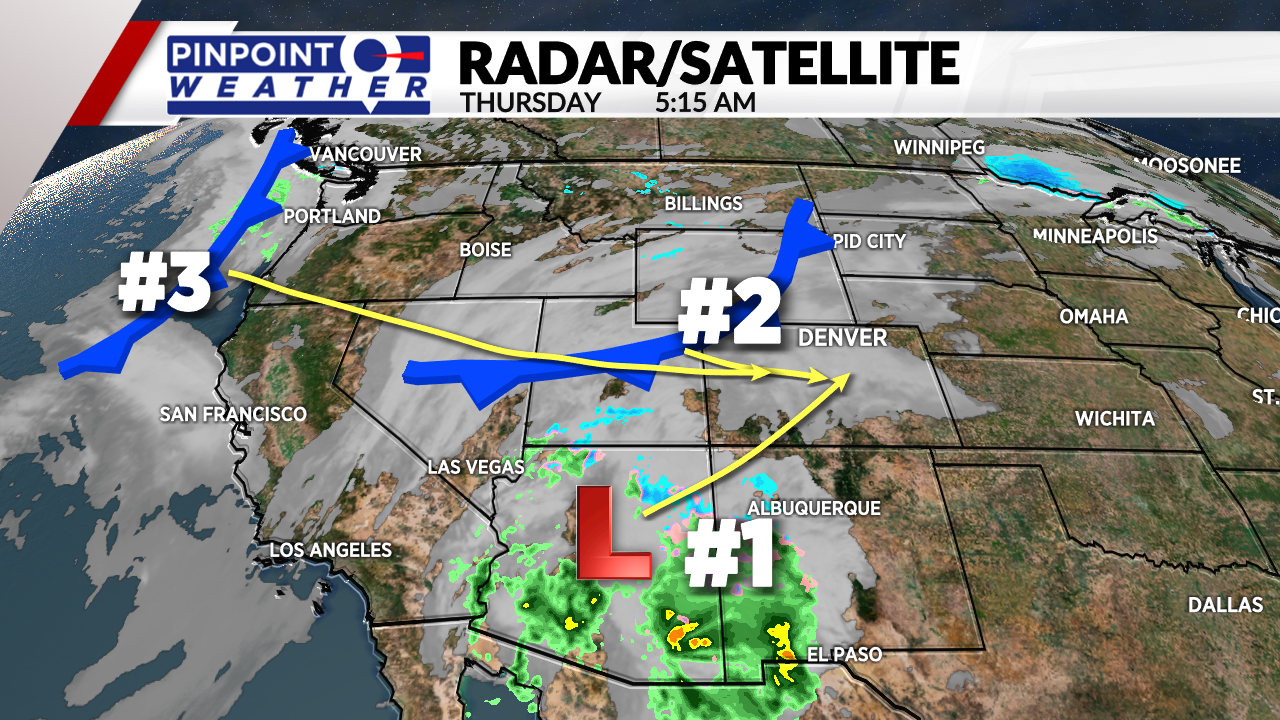
DENVER (KDVR) — We are forecasting increasing cloudiness today in Denver and across the mountains. Front Range highs will be in the 40s. Mountain highs will be in the 30s.
Snow hits the Southern Mountains first today then overspreads the rest of the state by tonight.
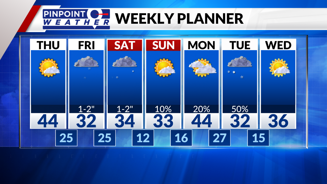
Light snow is likely in Denver and across the Front Range by early Friday morning. 1-2 inches of accumulation by Friday night. Colder highs in the 30s.
The mountains will get 1-4 inches by Friday night. Then a big break in the action.
The second part of this storm arrives Saturday midday through Saturday night. Another 1-4 inches in the mountains, and 1-2 inches for Denver and the Front Range. Snow tapers off into early Sunday morning.
Another storm is on deck for Monday night into Tuesday. Mountains get moderate accumulations. Front Range gets light accumulations. Colder highs in the 30s.