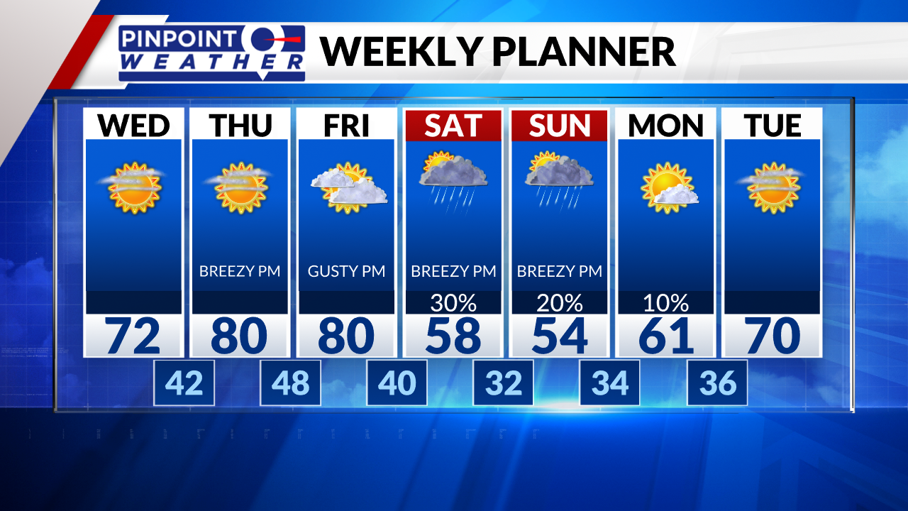
DENVER (KDVR) — The Pinpoint Weather team is forecasting Front Range highs in the low 70s on Wednesday with sunny skies and afternoon winds from 15 to 25 mph.
The mountains could see light morning snow with decreasing clouds afterward. Wind gusts will range between 30 to 60 mph above the treeline. Mountain high temps will be in the 40s and 50s.

Eighty-degree temps will return to Denver on Thursday and Friday. Gusty afternoon wind is likely on Friday, with 20 to 45 mph. High to extreme wildfire danger is expected.
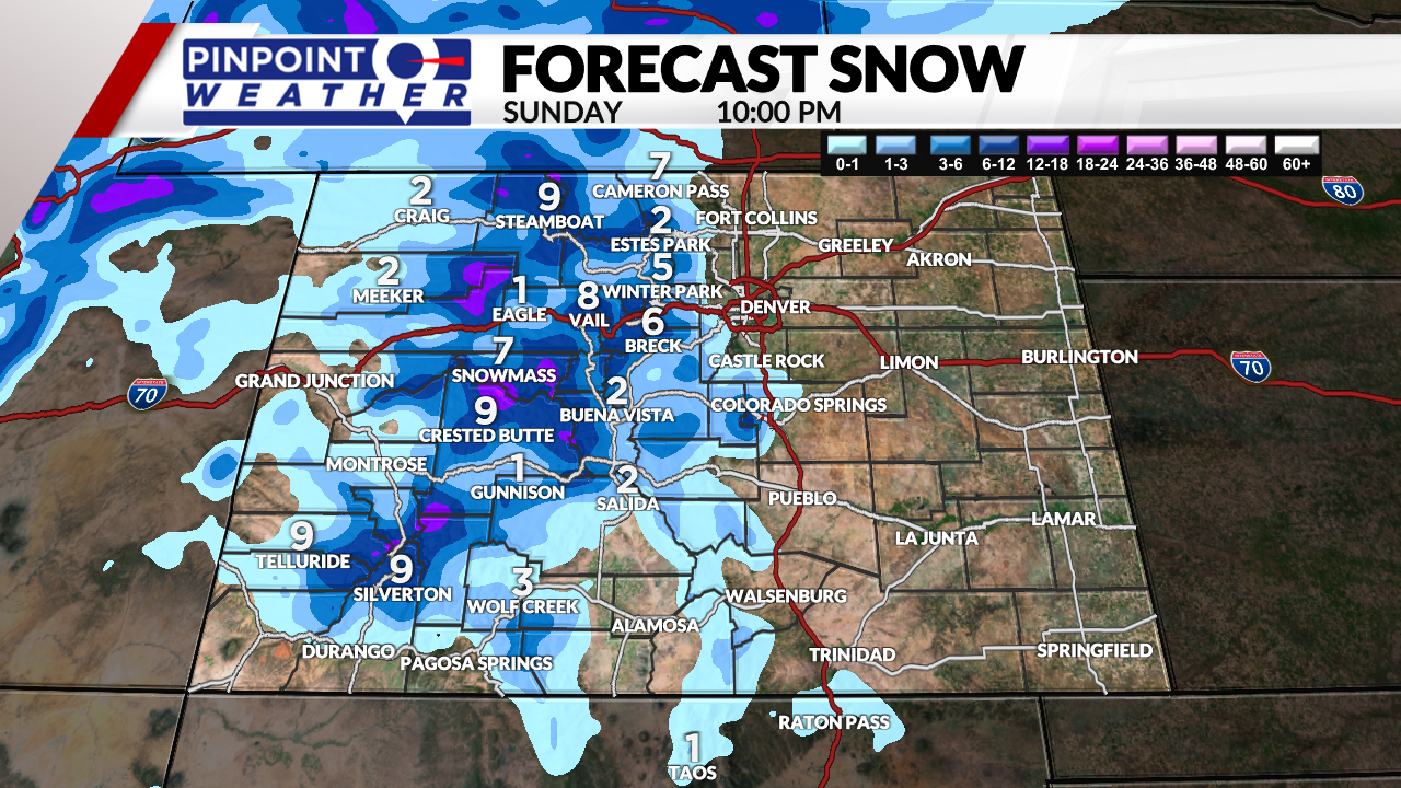
The next storm system will hit the mountains with rain and snow on Friday, then all snow on Saturday through Sunday. Four to 12 inches of snow accumulation above 8,000 feet is expected. A few pockets of 12 or more inches above 10,000 feet may be seen. Gusty wind with speeds between 40 to 70 mph is likely.
Across the Front Range, there is a 30% chance of rain on Saturday and 20% on Sunday. High temps will be cooler in the 50s.
The foothills and Palmer Divide could see a rain/snow mix between Saturday night and Sunday morning.
It will turn drier on Monday.

