This is an archived article and the information in the article may be outdated. Please look at the time stamp on the story to see when it was last updated.
DENVER (KDVR) — We’re forecasting a warm start to this week. Expect temps in the 50s on Monday with sunshine.
It’s a powder day in the Mountains after a “sleeper snow”. Skies will gradually clear by the afternoon.
The warmest day of the week occurs Tuesday with highs around 70.

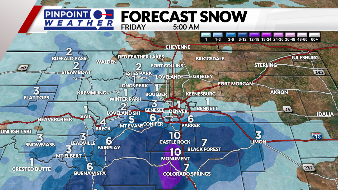
A warm storm system arrives Wednesday and Thursday. Precipitation will start as rain on Wednesday. Then a rain and snow mix will begin late Wednesday into early Thursday before changing back to rain. 1 inch of snow is expected in Denver.

Much heavier totals are expected to the south across the Palmer Divide with 4 to 10 inches. This will be heavy, wet snow.
Friday through Sunday will be dry and in the 60s.

