DENVER (KDVR) — Saturday and Sunday will be quite different as we track the return of rain and snow Sunday after Saturday hit the 60s at midday followed by a temperature drop through the afternoon.
The system on its way will spread rain and snow from the western slope into the mountains later Saturday and then rain and snow will move into the metro areas Sunday.
Read the latest watches/warnings/advisories for your area
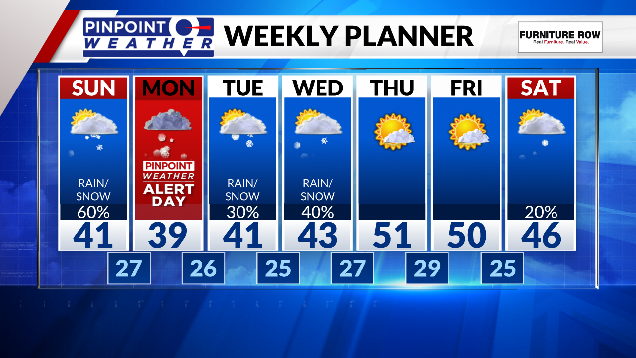
Temperatures will be in the 40s Sunday, implying that the city will have rain first then a changeover to snowfall later in the day lasting through Monday morning’s commute.
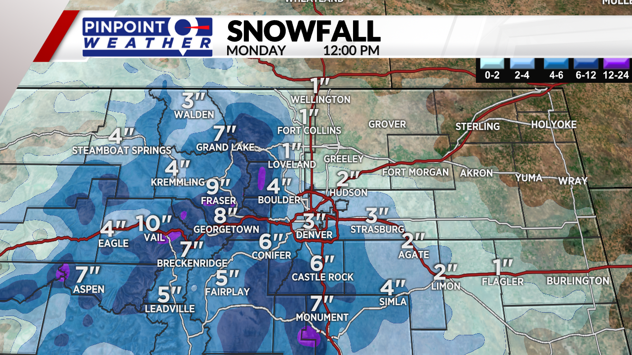
As far as snowfall, the most impacted areas will be west and south metro locations. Those higher elevations of Boulder, Jefferson, Douglas, Elbert and El Paso Counties are more likely to pick up several inches of snowfall.

Meanwhile, the lower spots like DIA to Greeley and onto the northeastern plains are less likely to accumulate as much.
For Monday morning’s drive, we have a Pinpoint Weather Alert in place. Roads may be slushy/snowy/icy for roughly half of drivers in the metro areas. Again, Monday morning is likely to be the peak of impact for this system.
This will kick off an active week of weather, rain and snow chances will continue for several days.


