DENVER (KDVR) — Parts of Colorado’s mountains saw more than a foot of snow from the Monday-Tuesday storm system that swept across the state.
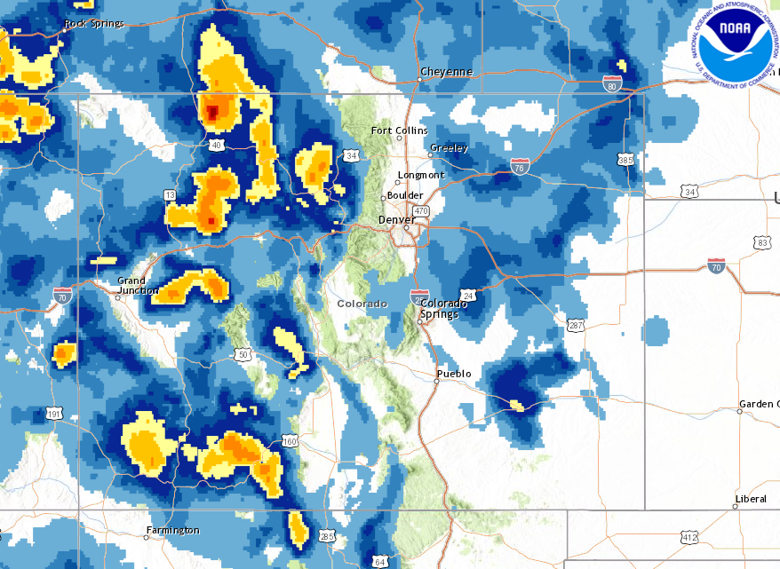
The map below is the snowfall analysis estimate from NOAA of how much snowfall fell in Colorado through 6 a.m. Tuesday. It visualizes the sharp cutoff of snow accumulation from the Eastern Plains, compared to no snow in Denver.
It also shows big totals in parts of Colorado’s mountains.

The pockets of yellow on the map above indicate snowfall totals of 8-18 inches. Some mountain towns, including ski areas, saw more than a foot of snowfall.
Below is a look at some of the 24-hour snow totals from the mountains, with 12 inches of fresh powder measured in Wolf Creek and Steamboat Tuesday morning.

There will be light lingering snow showers in the mountains through Friday and another snowstorm pushing in by the middle of next week.


