DENVER (KDVR) — Warm temperatures, gusty winds, and high fire danger have been the main impacts across Colorado on Monday. Winds will stay gusty into Tuesday as our next storm system arrives.
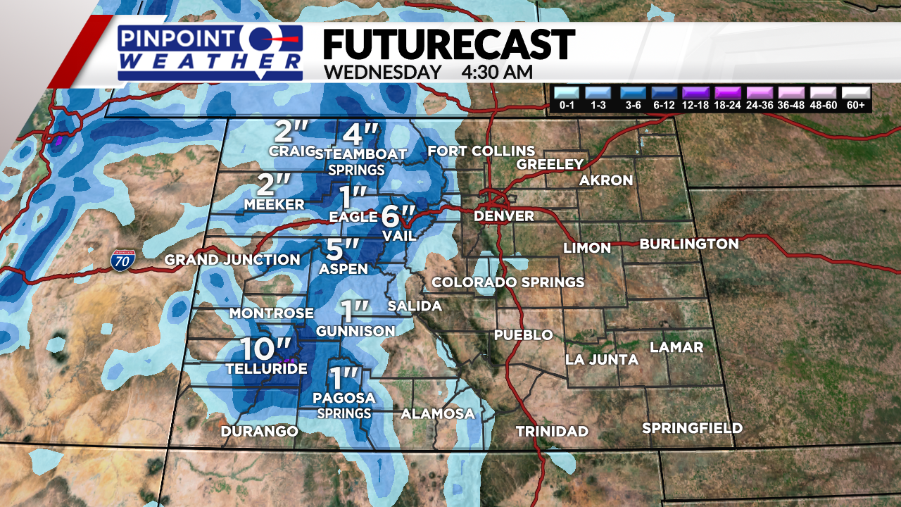
Rain and snow will start early Tuesday morning in Western Colorado and will slide east through the day. There will be scattered snow showers in the mountains throughout Tuesday that could lead to slick roads and slow travel.
By Tuesday afternoon, the Front Range and eastern plains will see rain showers. This storm system will move out early Wednesday leaving behind cooler air and dry conditions.
Snowfall accumulation will range from 1 to 6 inches in the central and northern mountains and up to a foot on some of the high peaks in the San Juans.

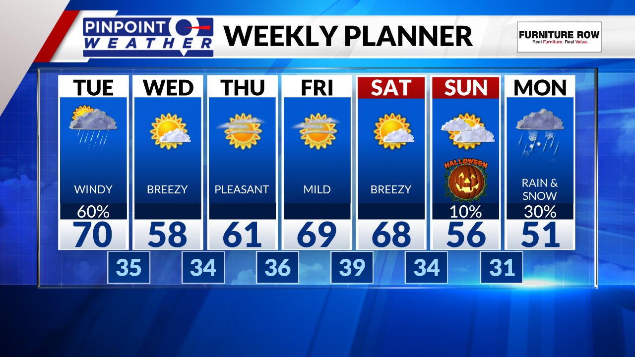
Wednesday and Thursday will still be breezy to gusty at times with cool temperatures and dry conditions.
Friday and Saturday will bring nice outside weather with highs near 70 and dry weather.
Cooler temperatures move in for Halloween with a 10% chance for showers late in the evening. Rain and snow showers are possible by Monday with our next big storm system.


