DENVER (KDVR) — Tuesday morning’s snowstorm dropped a few inches of snow on the Front Range but it was a different story on parts of the Eastern Plains, where nearly 2 feet of snow fell.
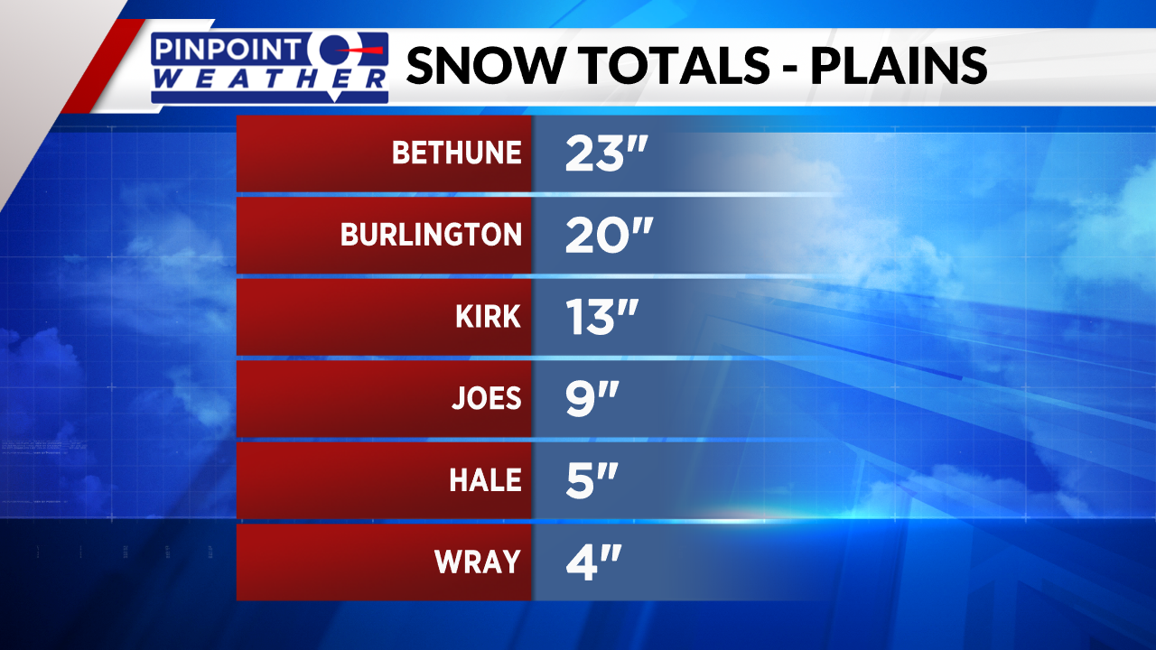
The snowfall totals from the plains range from a few inches up to 23 inches. Bethune, a small town north of Interstate 70 and west of Burlington in Kit Carson County measured 23 inches of snow on Tuesday.
Burlington, about 9 miles east of Bethune, also picked up an impressive total of 20 inches in just a few hours. Keep in mind that these are unofficial snowfall totals that were reported by people living in these areas.

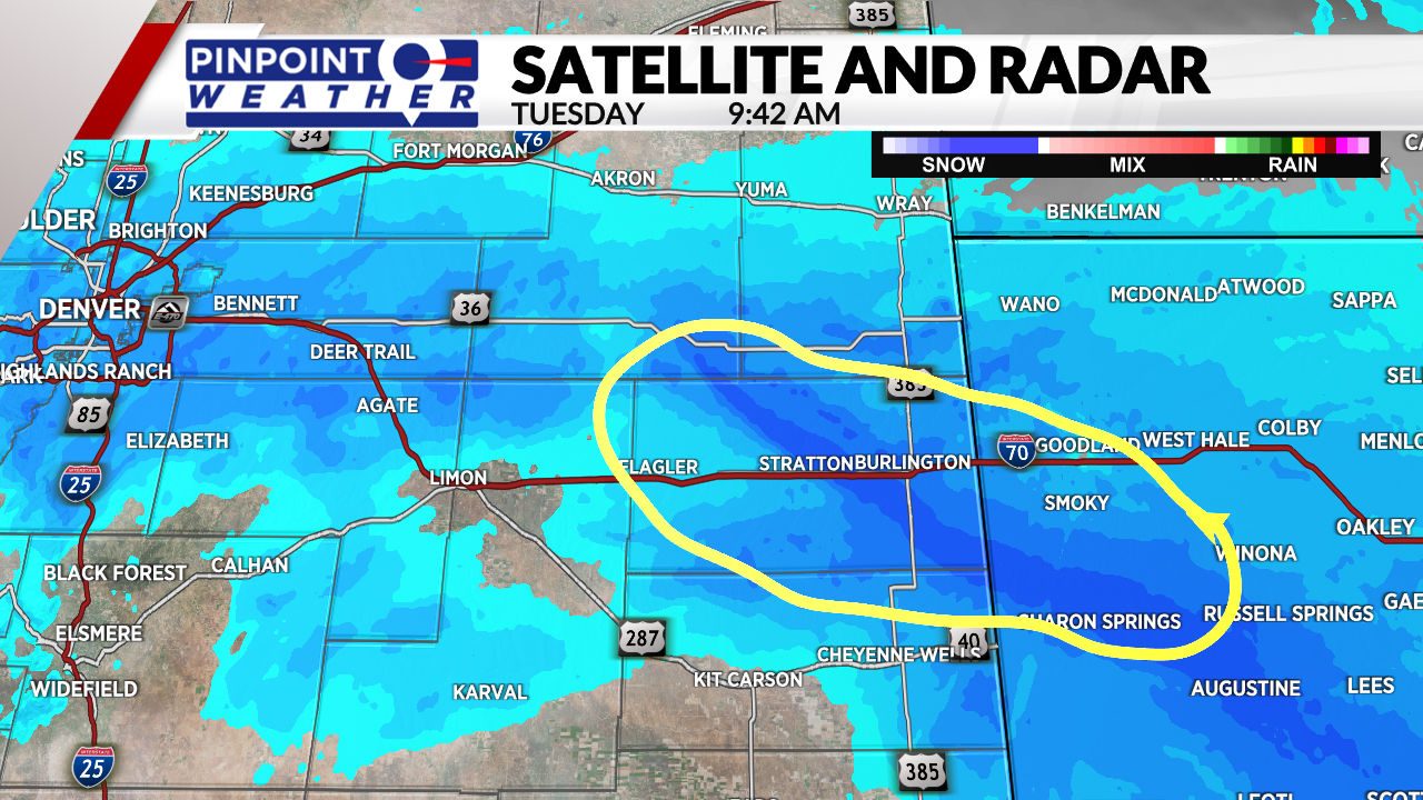
The reason for these really high isolated totals when nearby towns got fewer than 10 inches is because of a weather factor called snow banding. Snow banding is a heavy, typically narrow band of snow that concentrates over a specific area bringing higher snowfall totals there than places nearby. At times, snow bands can bring several inches of snow per hour.

Snow banding can form for a variety of reasons. Some of the most common in Colorado are from converging winds or a jet streak above the state.
Converging winds happen when winds from different directions collide in one area. A jet streak is an area of fast winds in the jet stream 5 to 9 miles above the surface.
The blizzard of October 1997 was one of the last times snow totals this big fell in that area of Colorado.

