DENVER (KDVR) — After a heavy snowfall, Denver’s weather will see some snowmelt before the next snow chance arrives.
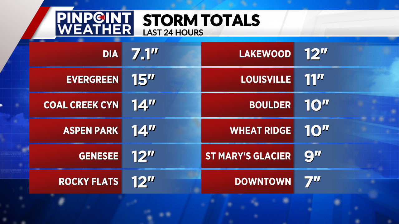
Wednesday’s snowstorm pushed Denver over the monthly snowfall average for December, with the city getting 7.1 inches of snow.
Weather tonight: Cold, partly cloudy
In Denver, we will see partly cloudy skies with lows around 17. In the mountains, there will be partly cloudy skies with lows in the single digits.

Weather tomorrow: Snowmelt
In Denver, there will be partly sunny skies and mid to upper 30s as a deep snowpack melts.
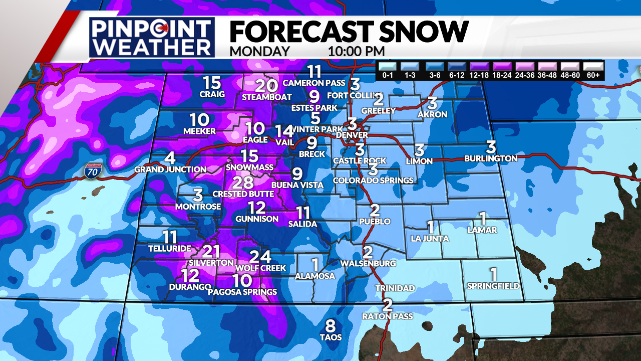
In the mountains, the atmospheric river delivers the next big storm system starting Friday afternoon and continuing into Monday morning, bringing big snow totals this weekend.
Looking ahead: More snow to come
Denver will remain mostly dry with partly to mostly cloudy skies this weekend. High temperatures will be in the upper 30s and low 40s as we continue to see the deep snowpack melt.
In the mountains, heavy snow is expected, especially across the Western Slope.
Mountain snow forecast timeline:
- Friday night: 1-4 inches
- Saturday: 6-12 inches
- Sunday: 2-4 inches
- Monday: 4-8 inches


There is a small chance for light snow very late Sunday. The best chance for accumulation is on Monday with 1-3 inches possible. There will be colder temperatures in the 30s and 20s.

