DENVER (KDVR) — Storm systems that are still a week away can be extremely hard to forecast in Colorado. With Colorado’s next snowstorm about a week away, there are still many uncertainties.
When storm systems are over seven days out, there are a lot fewer forecast models for meteorologists to use than when it is only a few days away. Because of this, there are typically big changes in the forecast between seven days out and two or three days out from a snowstorm.
Denver and the Front Range have been mild and dry to start off December but a storm pushing in early next Monday night into Tuesday will change that.
The graphics below are a little glance at what meteorologists look at when a storm is a week away and how tough it can be to forecast them.
Here’s what the Pinpoint Weather team knows so far: This system will bring cold temperatures and snow for some, but the timing and totals are still in question.
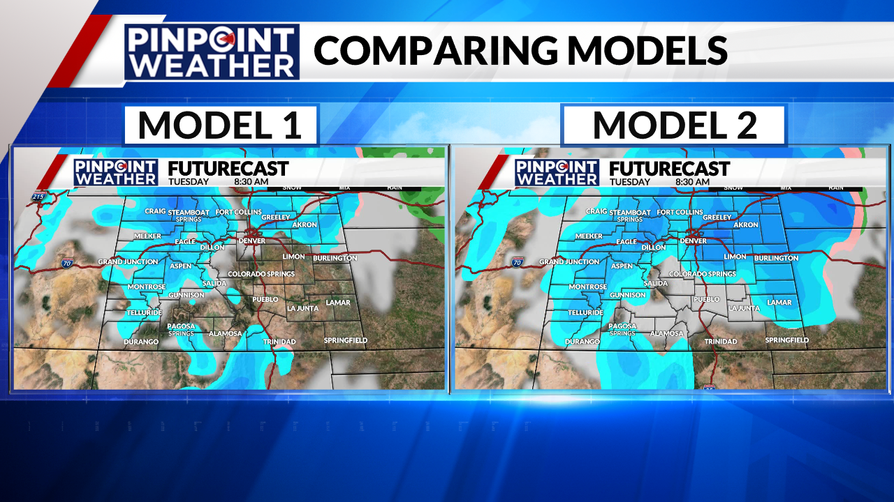
The graphic below shows two weather computer model outputs for the Tuesday morning commute around 8:30 a.m. These outputs are from Monday afternoon, showing a forecast that is about eight days out.

Model 1 shows snow staying mostly north and west of metro Denver, while model 2 shows snowfall covering the Front Range, including metro Denver, for the morning drive.
The output of Model 2 would lead to a longer amount of snow falling, a higher chance for snow, and shows a total of 3.5 inches by Tuesday night in Denver.
Model 1 shows only a small chance for an isolated shower in Denver with no snowfall accumulation in the city.
The numbers and timing will change from now into the weekend. The takeaway is that some areas will see snowfall late Monday into Tuesday of next week but the details are still unknown. Temperatures will likely only reach the 30s with impacts on the Tuesday morning commute.
The Pinpoint Weather team will keep you updated as the storm system gets closer.

