DENVER — February has been relatively quiet in the snowfall department.
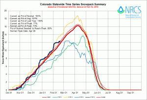
Yet, thanks to some heavy snows in December and January the state’s snowpack remains very slightly ahead of average at 105%.
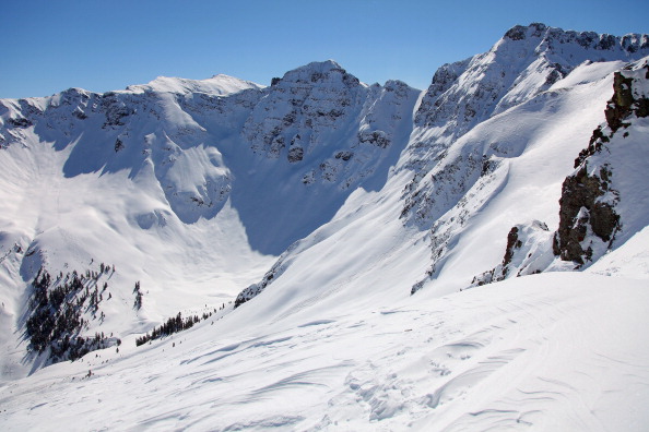
A close look at the state, you can see the southwestern mountains are in the best shape currently.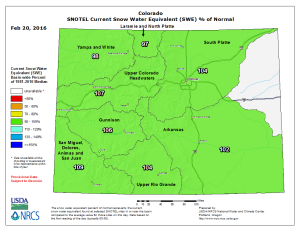
These measurements are taken at a network of SNOTEL sites. SNOTEL is an automated system of climate sensors, including snowpack/water measurements, that help conservation and water managers track the water availability.
Denver Water, for example, uses this information to plan drinking water use late in the year.
These snowpack numbers will increase this week as another snow storm moves through the state. This may not hit just the mountains but Denver has a chance for snow this time too.
The chance for Denver to have snow will increase early this week. Dave Fraser says, “A cold front arrives late Monday night into early Tuesday with our first chance for light snow in several weeks. We turn dry and mild again for the remainder of next week.”
Follow the Pinpoint Weather team for snowfall forecast information throughout the coming days.