DENVER (KDVR) — It’s the forecast fans of cold weather have been waiting for. A big change from the hot and dry end to summer and start to fall in Denver is on the way, and it moves in next week.
This storm system could be the strongest of the season so far bringing some of the coldest temperatures since May and a chance at accumulating snow for most of the higher elevations.
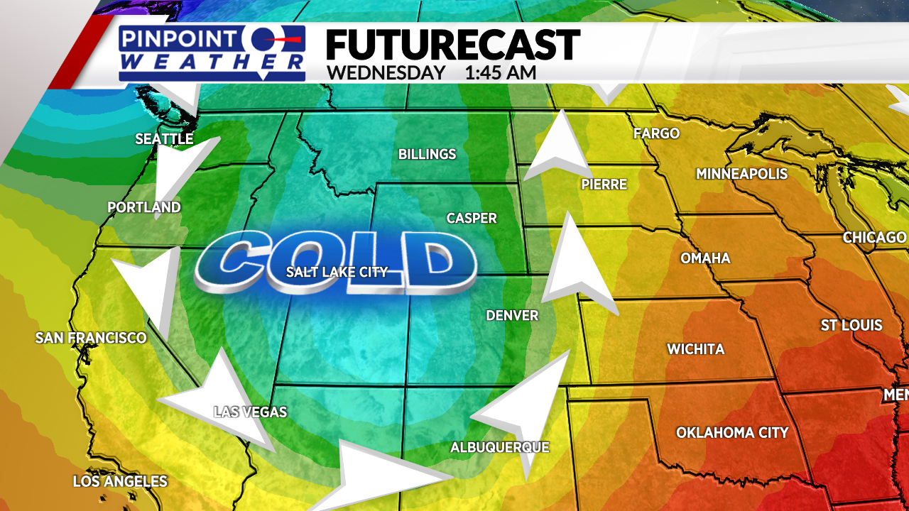
The incoming system is a big drop in the polar jet stream filtering in much cooler air from the north. The low pressure associated with this storm system will bring unsettled weather, meaning better chances for precipitation in Colorado.
This storm system is still over a week away so the timing and details will continue to change. As of Tuesday afternoon, it looks like Wednesday, Oct. 13 will have the biggest impacts on the Front Range with both colder air and precipitation in the forecast.

The 6- to 10- day outlook from the NOAA Climate Prediction Center shows agreement with current weather models in a big change coming.
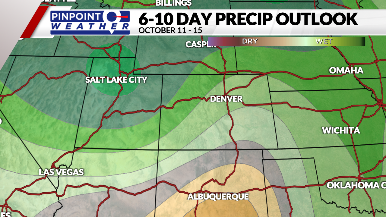
The 6- to 10- day outlook for Oct. 11-15 shows a decent chance for above average precipitation.
How much precipitation can Colorado expect?
The storm system is still too far out to pinpoint those details, but this could potentially bring the biggest snowfall to the mountains so far this fall season. This is great news for Colorado’s ski areas, who are relying on cooler temperatures and more moisture to get ready to open.

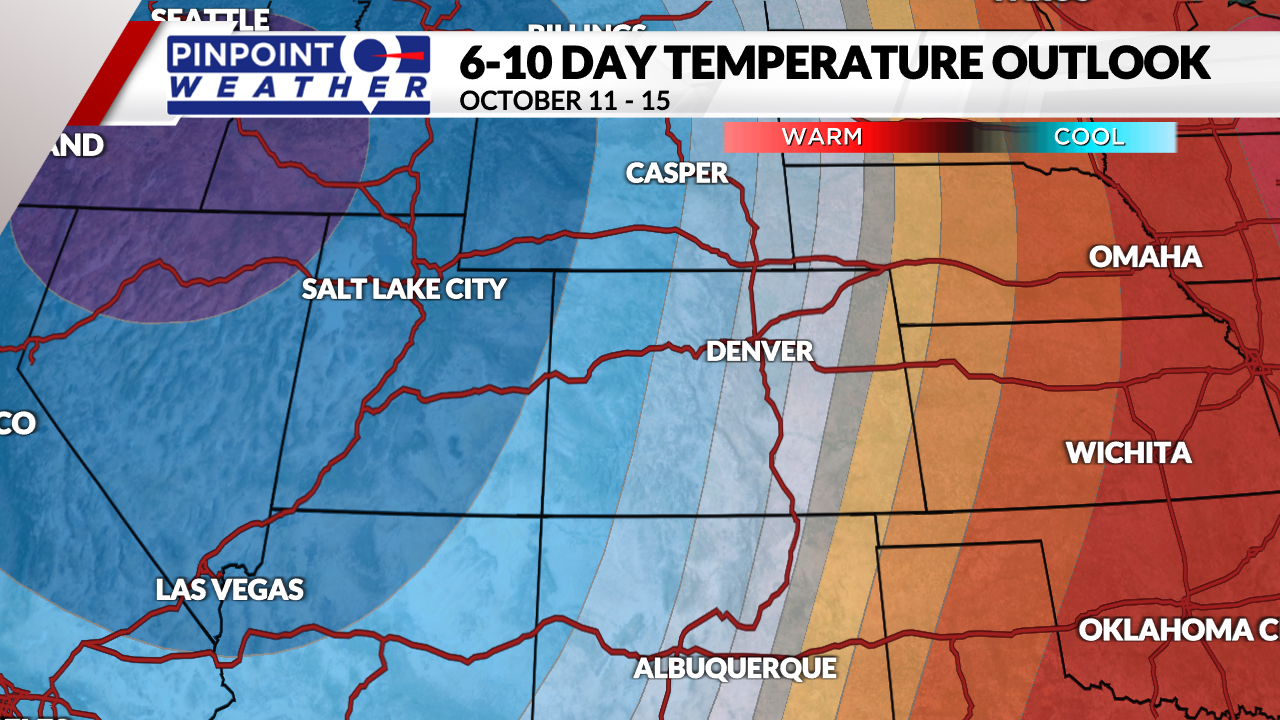
The 6- to 10- day outlook for temperatures Oct. 11-15 shows a good chance of lower than average temperatures across the Front Range and western half of the state.
Some weather models cool high temperatures to the 50s in Denver on Wednesday and overnight lows into the 30s. As previously stated, the details aren’t ironed out yet, but once the storm system gets closer, the Pinpoint Weather Team will keep you updated.


