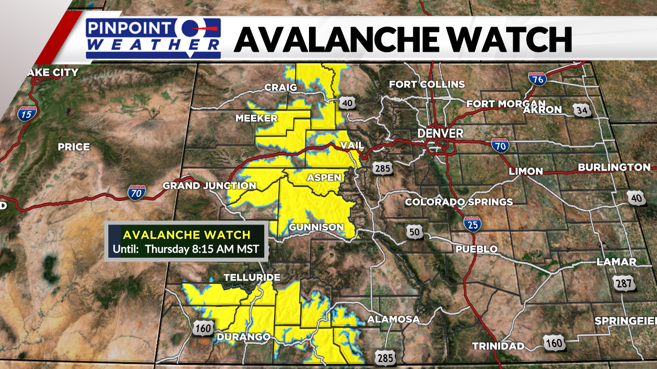
DENVER (KDVR) – More snow and high winds are expected into the mountains as the end of the year approaches, so avalanche watches are in effect through Thursday morning when warnings are then expected to be issued.
New snowfall totals through Saturday morning can be between 6 inches and 18 inches in the higher elevations. Aiding in the dangerous conditions, breezy winds, with gusts up to 75 mph, can be expected for Thursday and into Friday.

The base snowpack from November and early December is now old and weak snow. Just in the last week an additional 2 to 4 feet of snow have fallen and that makes for an unstable environment in the backcountry. A high risk for avalanches is forecasted through the end of the week, mainly at or above the tree line. Ranges with a high risk for Thursday, Dec. 30 include Aspen, South San Juan, Gunnison, Steamboat & Flat Tops, and Grand Mesa. Ranges with a considerable risk for Thursday include North San Juan, Sawatch, Vail & Summit County, and the Front Range.

Travel in the backcountry is not recommended with this elevated risk. Wide breaking avalanches can form quickly with large cracks being observed. Beware that avalanches can also be triggered from below so keep an eye out for steep slopes above you if you decide to venture into the backcountry.
The higher avalanche risk should begin to drop by the end of the weekend with a break from mountain snow through the first few days of the new year.


