DENVER (KDVR) — It has been a dry fall and start to winter in Colorado with drought conditions covering the state. Currently, Colorado’s snowpack is at 84% of average for this time of year.
Most of Colorado’s western and northern river basins are under 80% of average. This directly correlates to where there is exceptional drought in Colorado which is the worst rank of drought on the scale of 1 to 5.
The Arkansas and Upper Rio Grande river valleys are the only two areas in Colorado with above 100% of average snowpack.
This year has been very different for snowpack compared to January last year. The year 2020 started off on a different note with 121% of average snowfall on this day last year.

Looking ahead in the forecast, there are multiple chances for snowfall for the mountains over the next week.
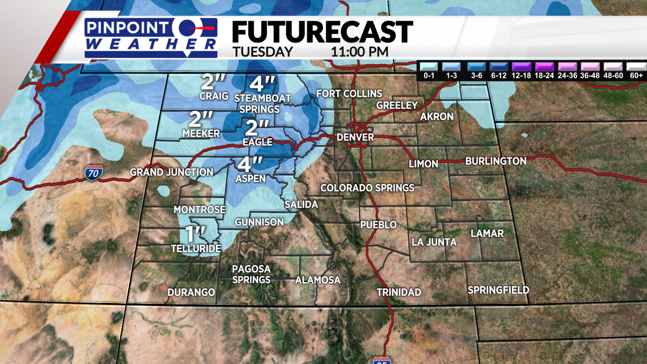
The first chance will come on Tuesday as a cold front moves across the state. There will be scattered snow showers across the central and northern mountains throughout the day that will end by early Wednesday morning.
Snowfall totals will range from 1 to 5 inches with this storm. Most of the accumulation will be concentrated in the areas that have low snowpack so that should minimally help out snowpack numbers at least.
Another shot at snowfall will move in on Friday and Saturday.


