DENVER (KDVR) — Abnormally warm temps arrive Monday and Tuesday, sticking around 60 degrees with breezy, downsloping winds.
It will be sunny on Monday, turning partly to mostly cloudy on Tuesday.
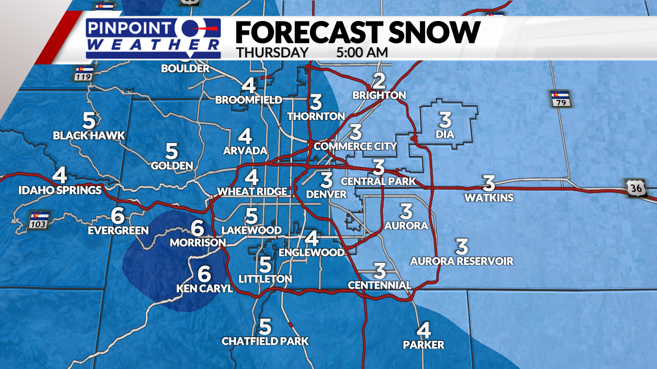
Snow hits the mountains by Wednesday morning, coming to Denver roughly by noon. The snow will start around 7 a.m. for Fort Collins, Boulder, Estes Park, and the northern mountains. Temps on Wednesday stay at freezing or colder. The snow will end around midnight.
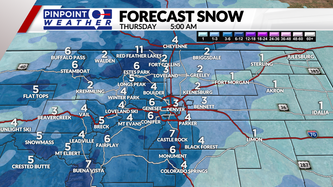
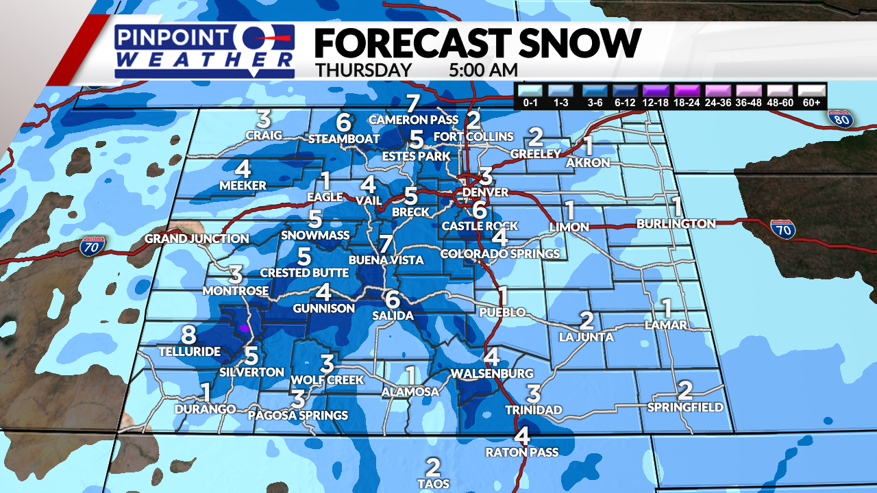
Totals by 5 a.m. Thursday:
- Denver: 2 to 4 inches
- Fort Collins: 2 to 4 inches
- Palmer Divide: 3 to 7 inches
- Foothills: 4 to 8 inches
- Mountains: 4 to 10 inches
- Eastern Plains: 1 to 3 inches
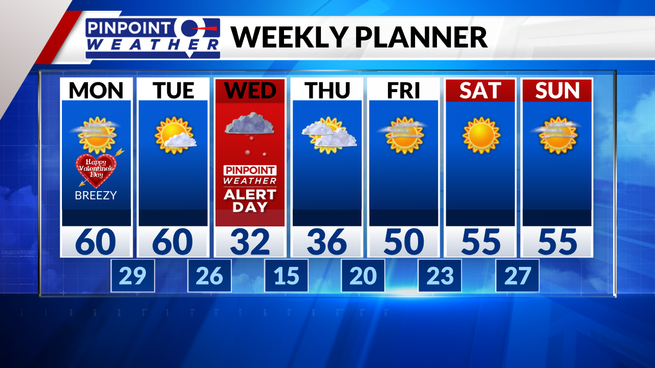
Skies will be clear on Thursday.
Conditions will be dry on Friday, Saturday and Sunday. The next storm system is expected to arrive Monday through Tuesday.

