This is an archived article and the information in the article may be outdated. Please look at the time stamp on the story to see when it was last updated.
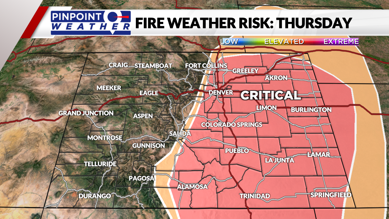
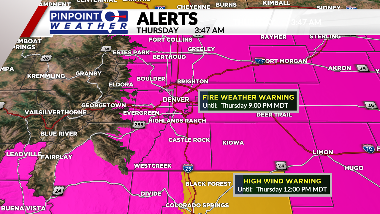
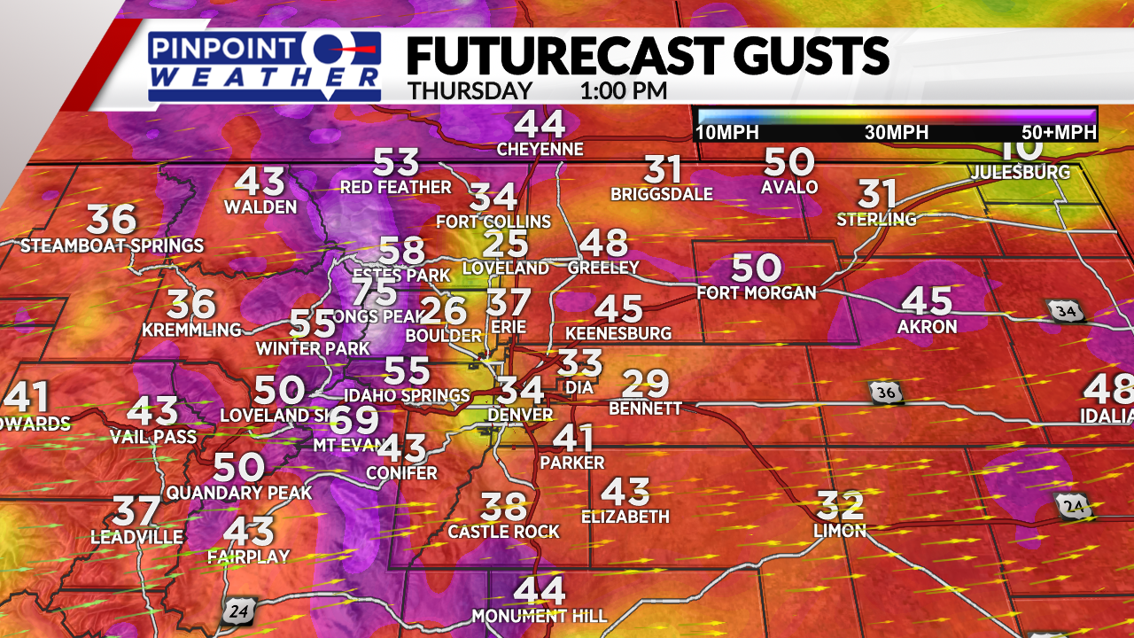
DENVER (KDVR) — The Pinpoint Weather Team is forecasting critical wildfire danger on Thursday. Temps will be cooler in the 70s behind a cold front, but stronger wind gusts of 25-50 mph keep the wildfire risk critical.
The northern mountains could see a few rain/snow showers and gusty wind, blowing 30-70 mph. High temps will be in the 50s.
The central and southern mountains will stay dry with gusts around 30-70 mph.
The wind is expected to relax overnight into Friday but increases to 15-30 mph in the afternoon. High temps will be in the 70s.
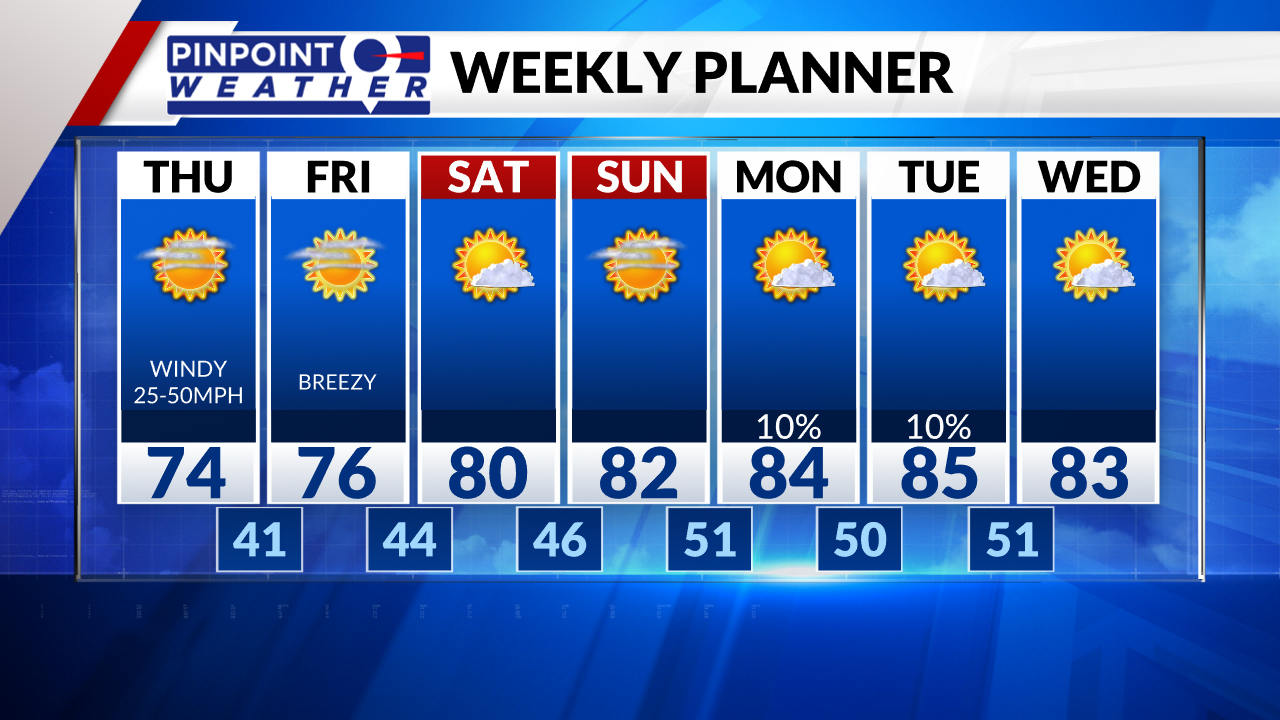
Saturday through Sunday feature less wind, sunny skies, and highs in the 70s.
We have a small 10% chance of afternoon rain/thunderstorms on Monday and Tuesday.

