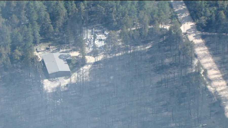
COLORADO SPRINGS, Colo. — The remains of two people were found at a home inside the Black Forest burn area, officials said, as the fire, the most destructive in Colorado history, continues to burn north of Colorado Springs.
El Paso County Sheriff Terry Maketa said the two people were found at a home in a heavily forested area.
The coroner has been called to the scene. Maketa did not name the victims.
“My heart, and I know the hearts of this community, go out to their family,” Maketa said.
Investigators talked to a person who had spoken with the victims on the phone Tuesday. At 4:20 p.m., the two said they could see the glow of a nearby wildfire and started getting ready to leave. About 40 minutes later, the caller told deputies they could hear “popping and cracking” on the phone before losing contact with the two victims, Maketa said.
Both were found in the garage of their home near a vehicle with its doors open. They appeared to be getting ready to leave, Maketa said.
Thursday, officials expanded the evacuation zone to include a portion of north Colorado Springs.
LINK: City and county evacuation areas
Chief of Police Peter Carey said troopers from the National Guard will help Springs police officers patrol the evacuated areas to make sure they are safe.
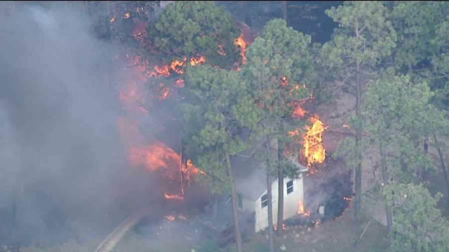
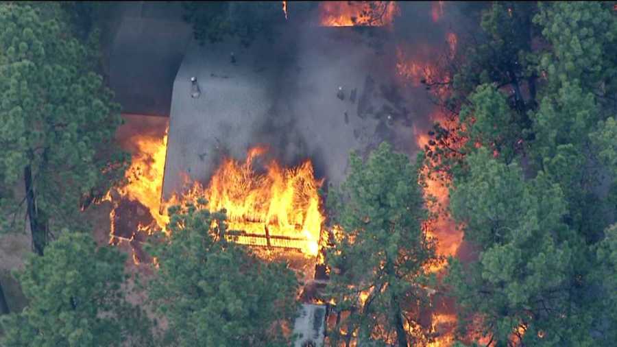
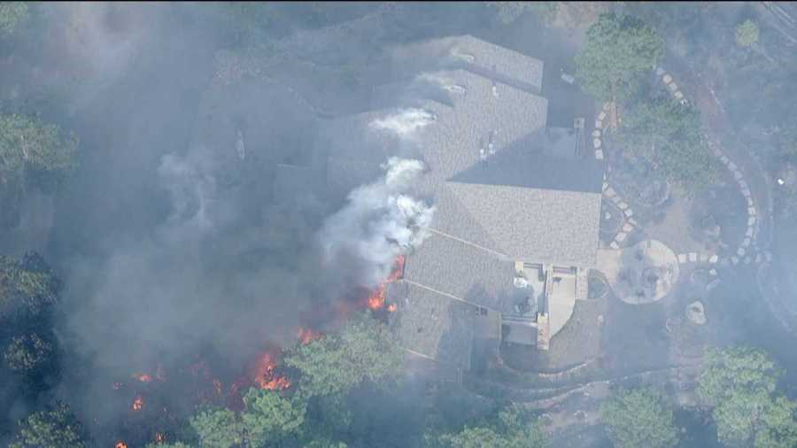
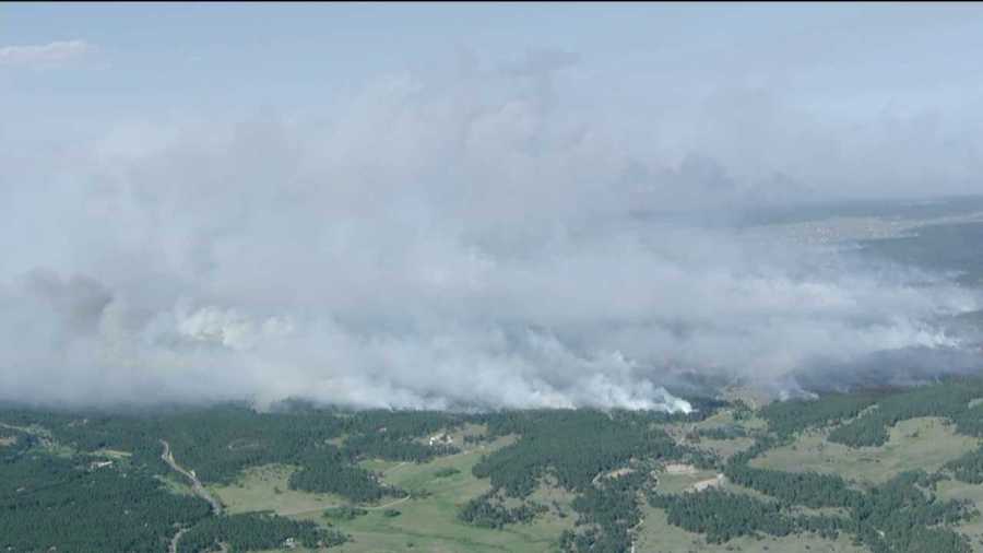
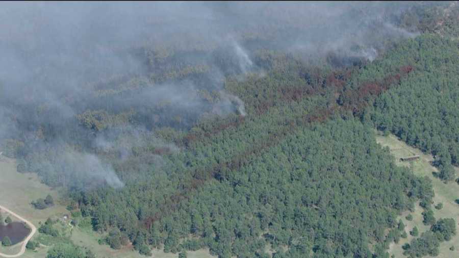
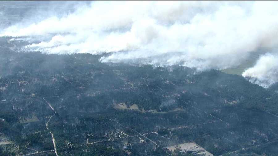
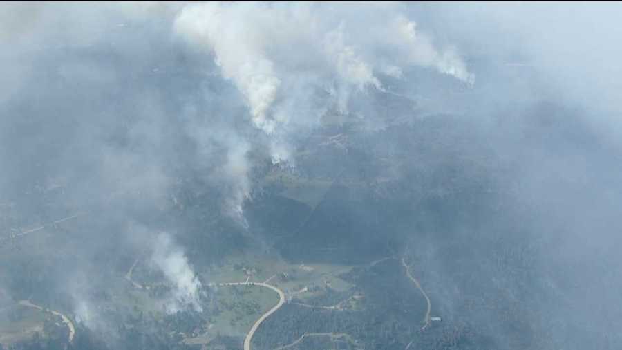
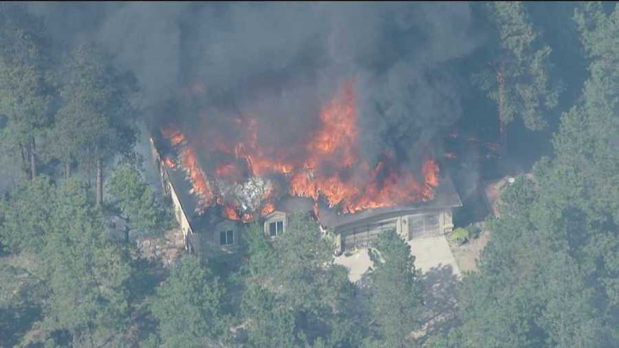
So far, the Black Forest Fire has burned 15,700 acres. It has displaced 38,000 people and affected about 13,000 homes.
It is now the most destructive fire in terms of property loss than any other in Colorado history, having destroyed 360 homes and damaging another 14.
Maketa said officials are still evaluating but he was “optimistically hopeful” no homes were lost Thursday.
LINK: Black Forest Fire – Residences June 13, 9 a.m.
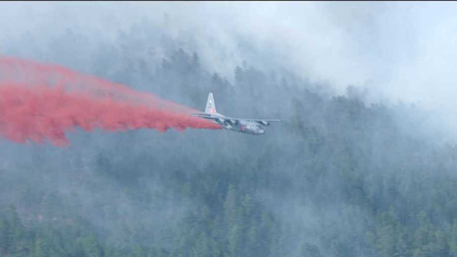
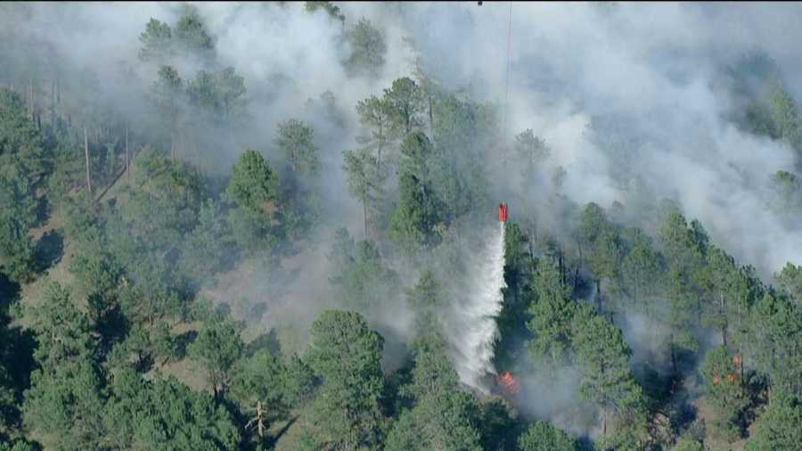
Incident Commander Rich Harvey said the south end of the fire “looked really well today” allowing him to call it 5 percent contained.
The north side of the fire was a “draw,” Harvey said, reporting that the fire didn’t move much, but neither were firefighters able to build containment lines he was comfortable with. Air tankers focused their efforts on the northwest side of the fire, hoping to stop its march toward higher ground.
The inferno is likely to continue for a couple more days as temperatures are forecast to stay in the 90s through Friday, with winds gusting up to 30 mph.
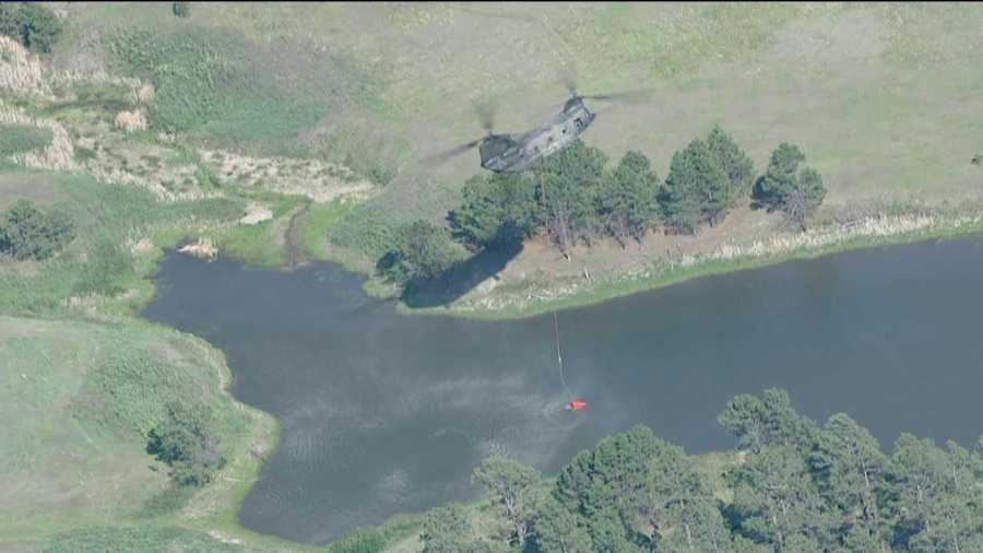
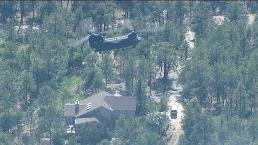
Fort Carson had 130 National Guard troops standing by to assist, including patrolling evacuated areas, setting up road blocks and supporting firefighters, said Lt. Col. Mitch Utterback.
Fort Carson also sent five helicopters to make water drops.
The Elbert County Fairground northeast of the Black Forest Fire looked like a Noah’s Ark Thursday with families who fled with their animals to escape the looming inferno.
There were nearly 30 chickens, several hundred horses, a handful of cows and a couple calves, and many alpacas and miniature horses, according to the Elbert County Sheriff’s Office. Assorted dogs, cats, goats and donkeys mingled with mules and lamas. Three stallions were there. And for good measure, one yak.
Colorado Springs Evacuation Zones
In Colorado Springs, the following areas have been evacuated:
Northern Boundary: North Gate and Old North Gate Road
Southern Boundary: Flying Horse Club Drive (to include homes south of Flying Horse Club Drive on Barossa Valley Road and Veneto Way)/Vine Cliff Heights/Equinox Drive/Serenity Peak Drive
Eastern Boundary: Highway 83 – Western Boundary: Voyager Parkway
LINK: Area A-1 evacuation map
Highway 83 is closed at Powers Boulevard. Police said evacuees should head west and out of the area.
A Red Cross shelter was set up at the University of Colorado at Colorado Springs.
Black Forest Evacuation Zones
In Black Forest, the mandatory evacuation zone was north to County Line Road, west to Highway 83, east to Eastonville Road, and south to Burgess Road.
Areas on pre-evacuation notice include:
Area 1 – Burgess Road south to Stapelton Drive, and Vollmer Road east to Meridian Road.
Area 2 – Latigo Blvd. south to Stapelton Drive, and Meridian Road east to Highway 24.
Area 3 – Guy Ranch Road south to Stapelton Road, and Eastonville Road east to Elbert Road.
Area 4 – Burgess Road south to Old Ranch Road and Poco Road, and Milam Road east to Vollmer Road.
Douglas County Pre-Evacuation Zones
In Douglas County, the pre-evacuation warning includes the following area: North of Black Forest which includes South County Line Rd (Douglas/El Paso Counties)north to Gillian Rd west to Hwy 83 and east to Elbert/Douglas County line.
Evacuation centers
The Red Cross is now operating shelters in the following locations:
Palmer Ridge High School (19255 Monument Rd., Monument). As of noon Thursday, there were 109 people registered there.
Elbert County Fairgrounds (95 Ute Ave, Kiowa). As of noon Thursday, there were 346 people registered there.
University of Colorado Colorado Springs Recreation Center (1420 Austin Bluffs Parkway, Colorado Springs). This shelter will open at 3 p.m.
Small animal assistance was being offered at Powers Pet Emergency, which can be reached at 719-473-0482.
Residents can call 719-444-8300 for more information about the fire.