DENVER (KDVR) — A strong storm dumped heavy rainfall and made a big impact on parts of the Denver metro on Sunday night. The storm dropped up to 3 inches of rain in some areas, causing major flooding on city streets.
Sunday’s storm was a result of tropical monsoon moisture in Denver, aiding developing storms in producing a lot of rainfall.
Below is a radar snapshot around 7:15 p.m. Sunday. It shows the storm moving through Northeast Denver, dropping inches of rain in spots.

The dark red and pink colors indicate where the highest rainfall rates were. Notice how some of the heaviest rain fell along Interstate 70, where major flooding and water rescues happened.
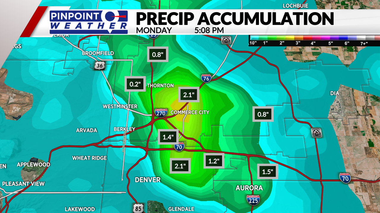
Other parts of Denver only saw a few tenths of an inch of rainfall, but areas in that strong storm on the northeast side of the metro saw anywhere from 0.5 to 2.5 inches of rainfall.
Below is a map of the radar-estimated precipitation accumulation. It shows the bullseye of heavy rain right over Commerce City, where more than 2 inches of rain fell.
The reason flooding happened on the roadways is because the areas here that picked up 1-3 inches of rain saw that fall in less than 30 minutes. For many areas, that is a month’s worth of rainfall in less than a half hour.

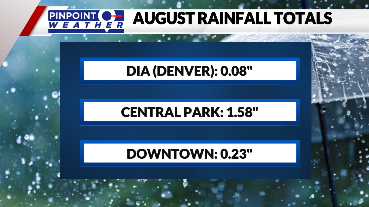
Like many monsoon storms in the last several weeks, Denver International Airport missed out on the moisture once again. Only a trace of rain was measured there Sunday evening.
August total rainfall at the airport is now at only 0.08 inches of rain, while nearby areas like Central Park have seen more than 1.5 inches of rainfall already this month. Central Park is only about 15 miles west of DIA.

Downtown Denver has seen about 0.23 inches of rainfall this month. Dry weather is moving in for the next few days with rainfall returning for next weekend.

